Travel Notebooks
Arizona, autumn 2024
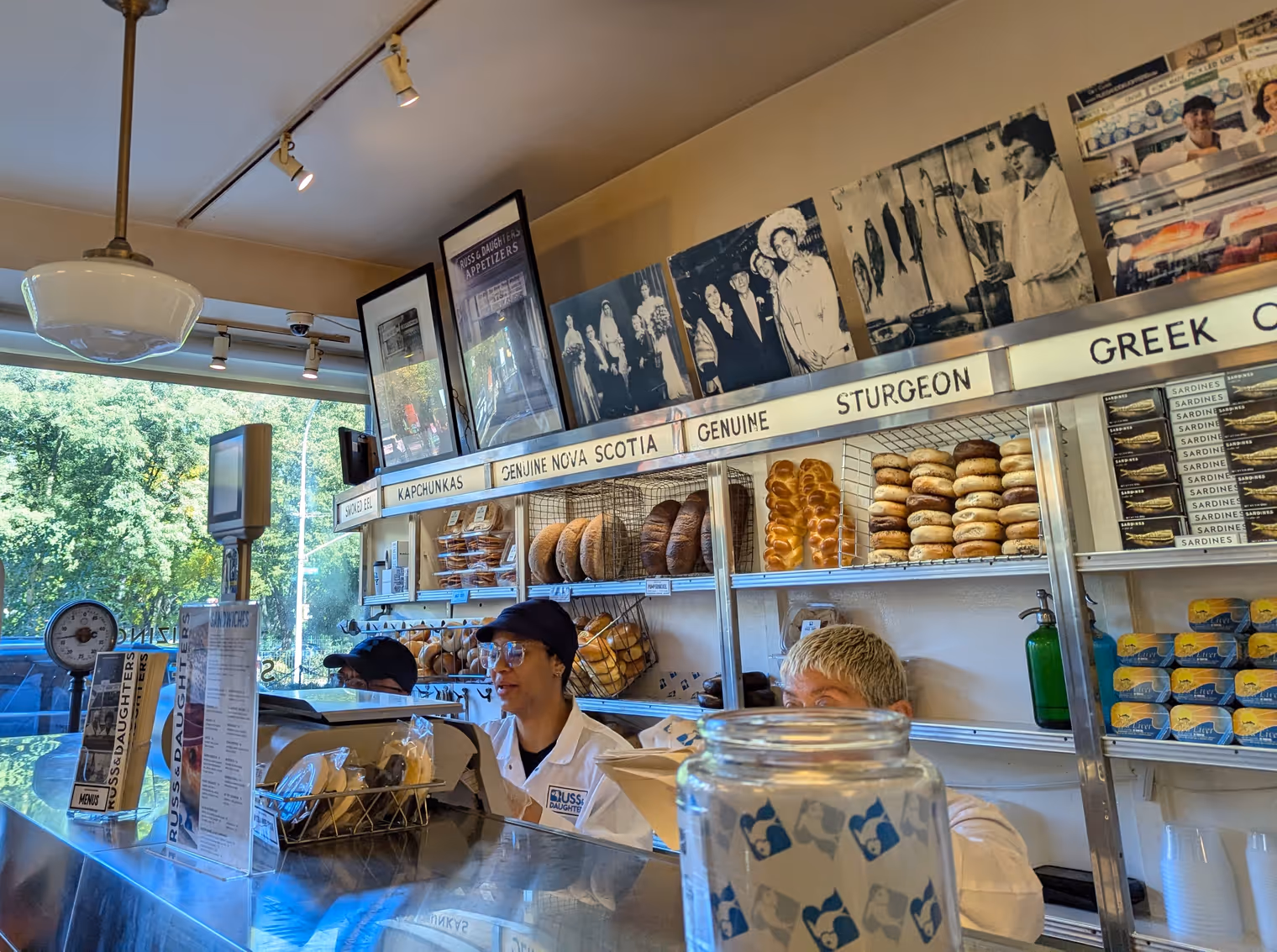
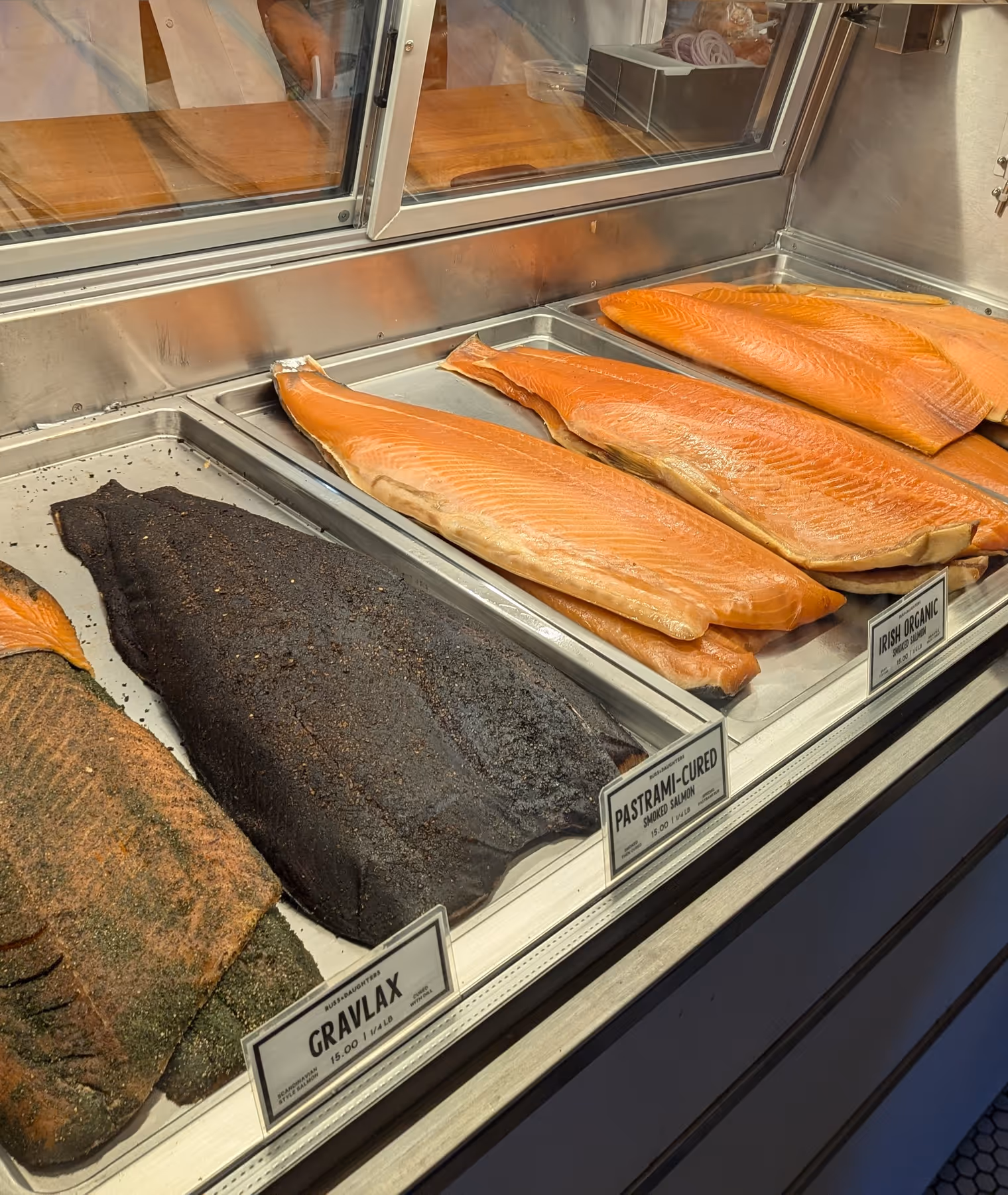
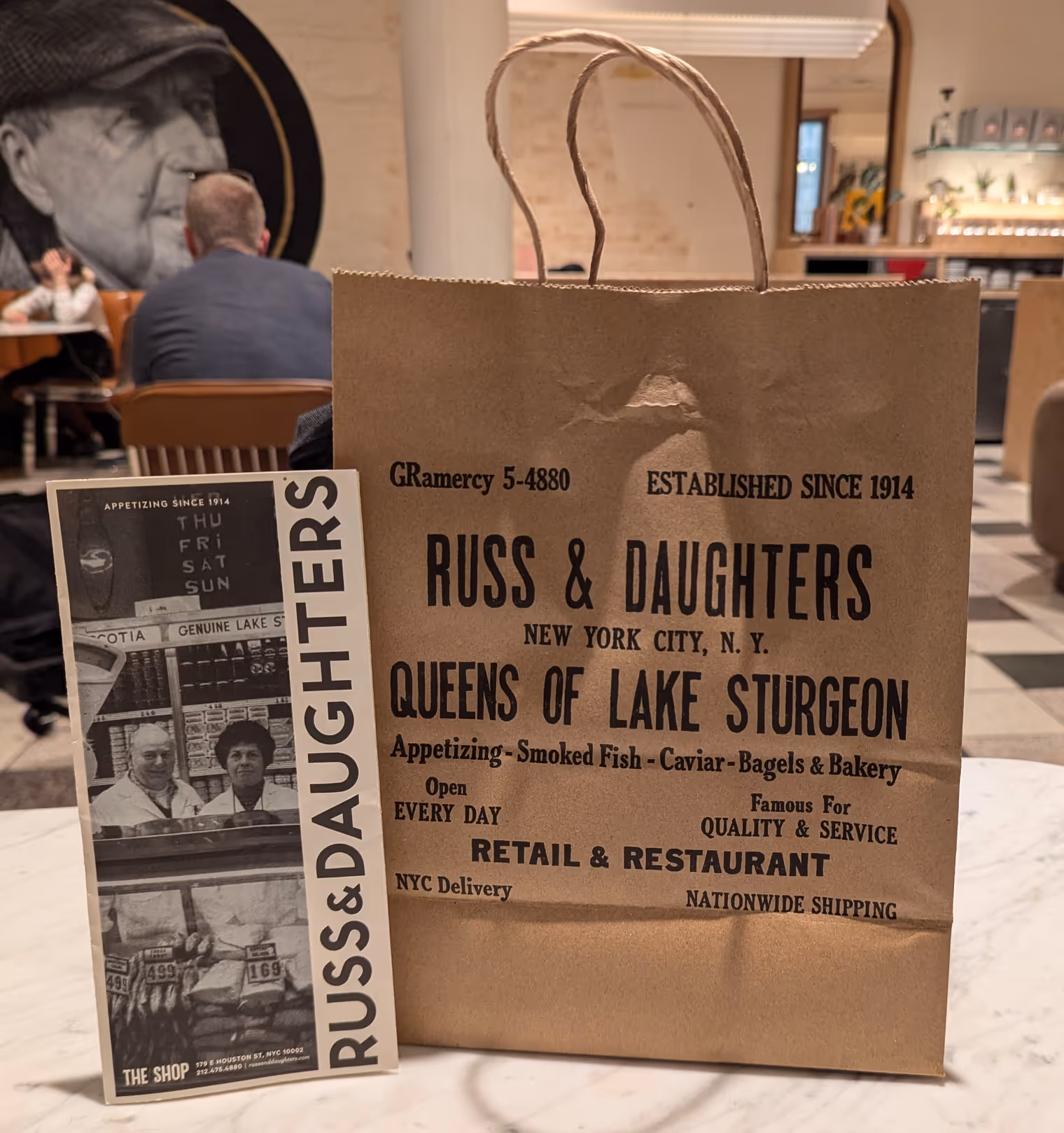
October 17, last day as a New Yorker. After a bagel with cream cheese and smoked salmon—which took us half an hour in line at the historic deli Russ & Daughters—Goda and I say see you on November 2. She gets on the subway to Newark Airport, from which she’ll fly back to Vilnius. I, on the other hand, head to JFK to catch my flight to Phoenix. There I’ll meet Davide, with whom I’ll spend the next two weeks roaming by bike in southern Arizona.
Goodbyes for me always come with a veil of sadness and anxiety; that feeling we call “magone” in northern Italy. But that’s the way it is. I know it’ll pass. I let myself be distracted by the grandeur of JFK airport, which I watch through the window of the elevated train that links the terminals.
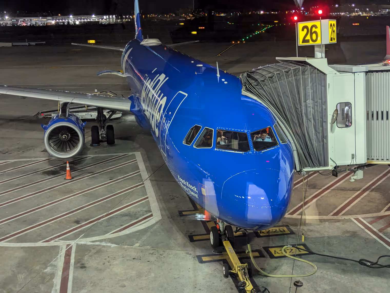
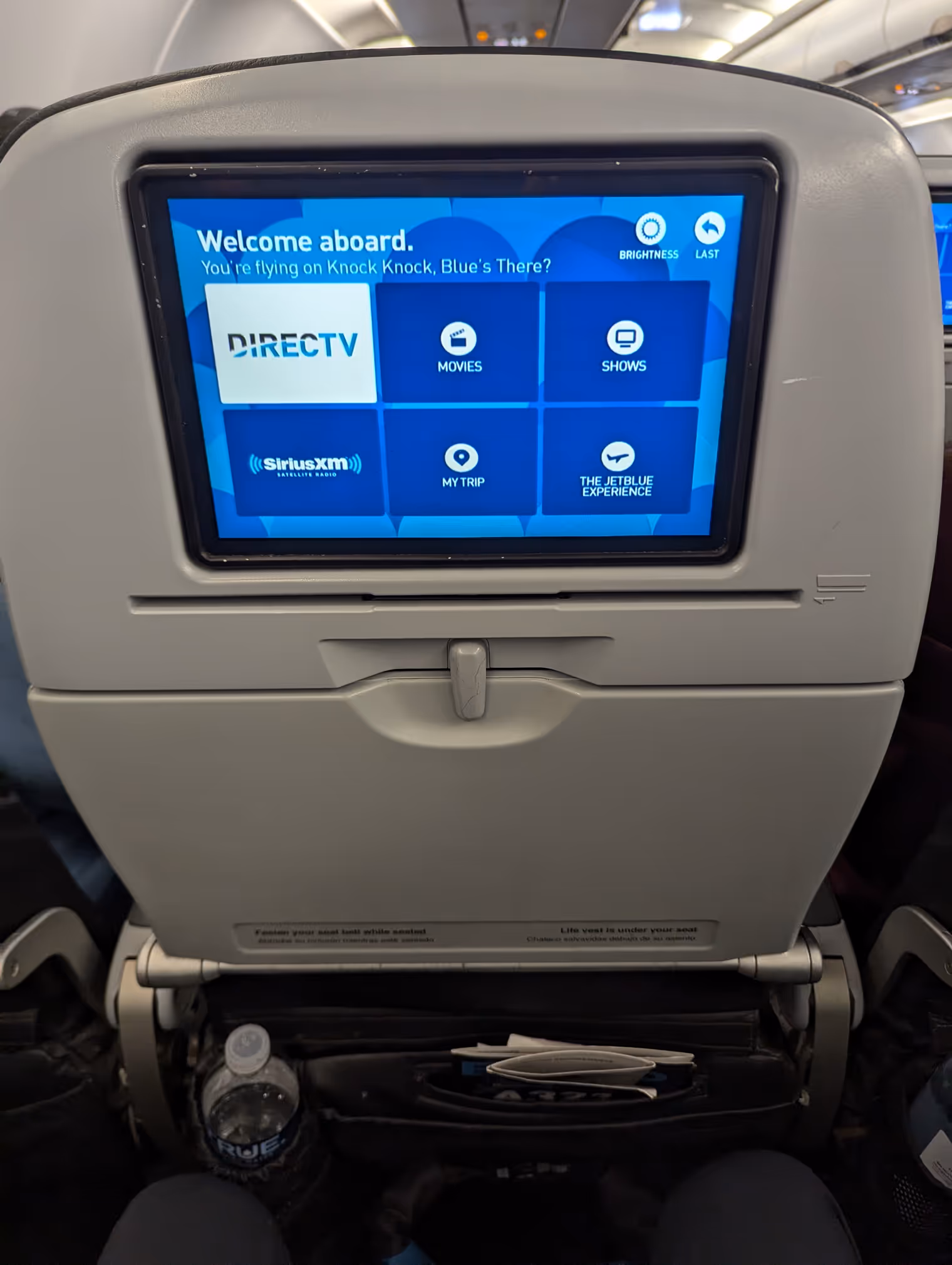
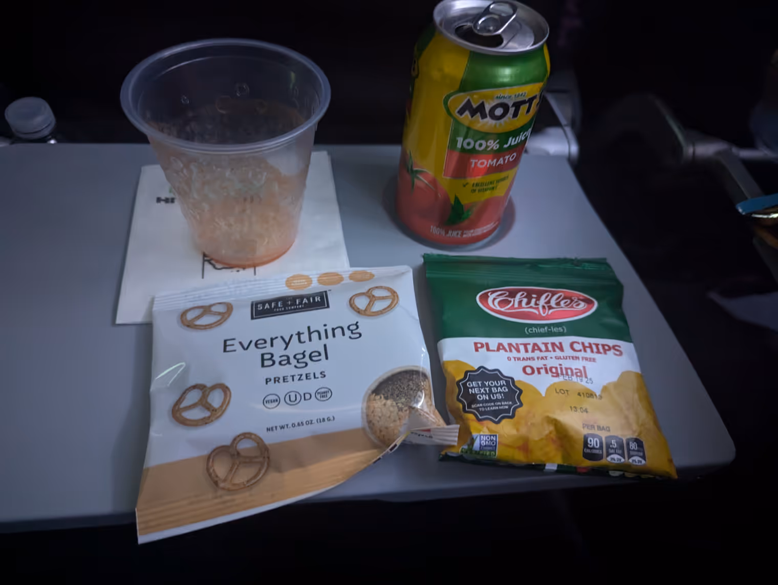
My JetBlue flight leaves from Terminal 5 and will take about four and a half hours to reach its destination. Although it’s a low-cost, I have to say it’s much better than the European equivalents I’m used to: more legroom, in‑flight entertainment, and complimentary snacks and drinks.
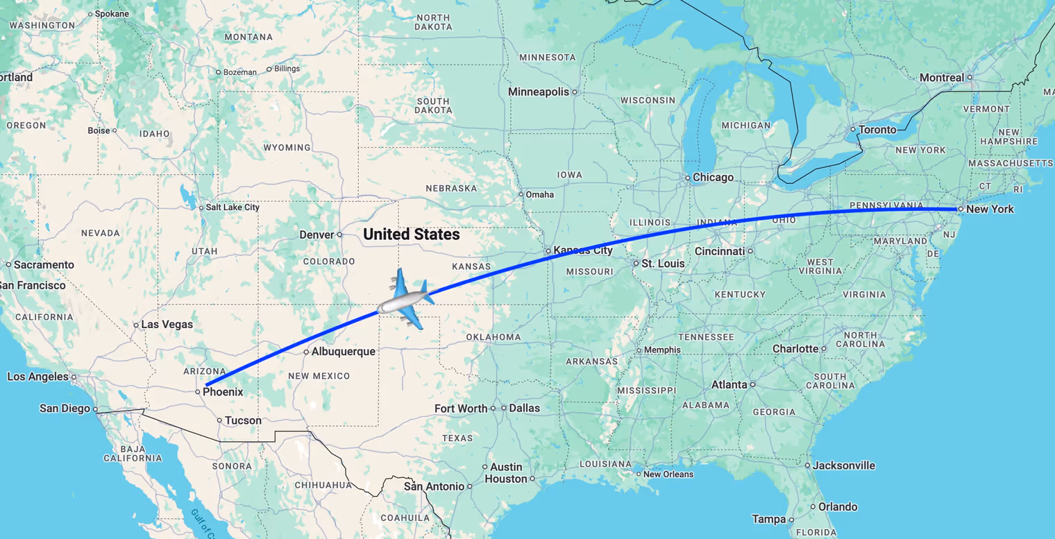
I arrive in Phoenix at 11 p.m., and a shuttle takes me to the hotel, where I meet Davide. He’s been in bed for a few hours already, but he’s having trouble sleeping since he arrived from Japan where it’s now broad daylight. My circadian rhythm is tuned to New York time instead, and I quickly fall asleep on the comfy Hilton mattress.
Day 1: from Phoenix to Three Points
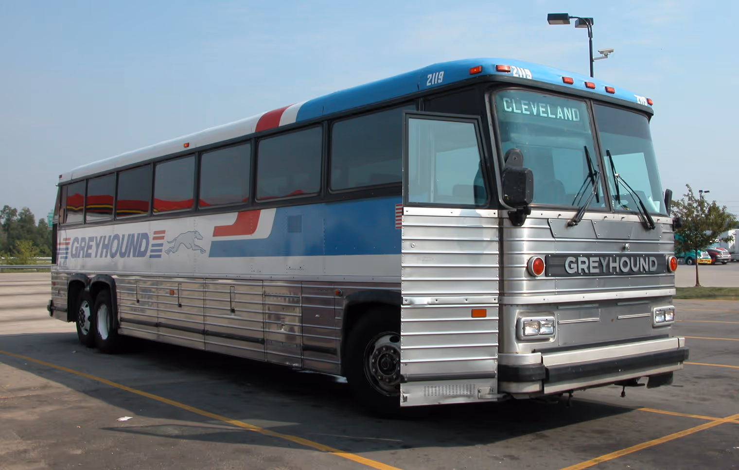
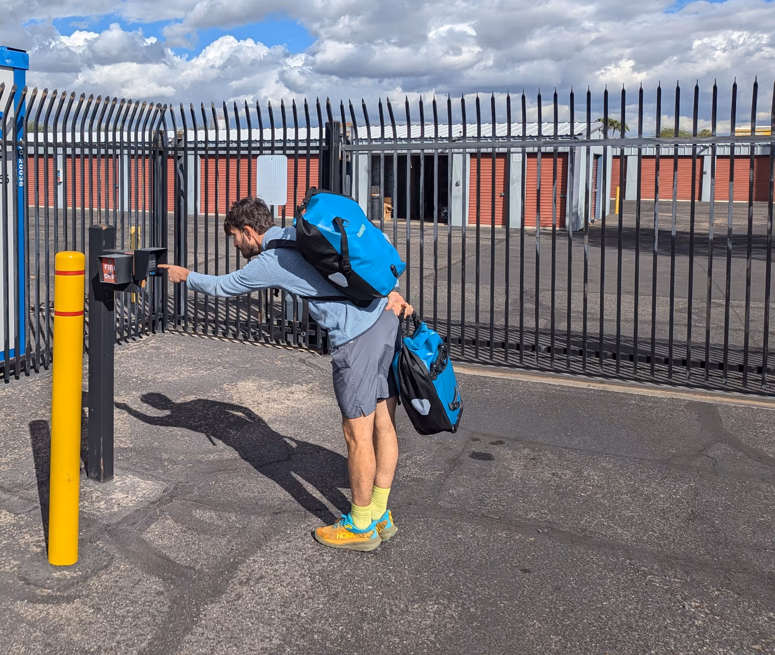
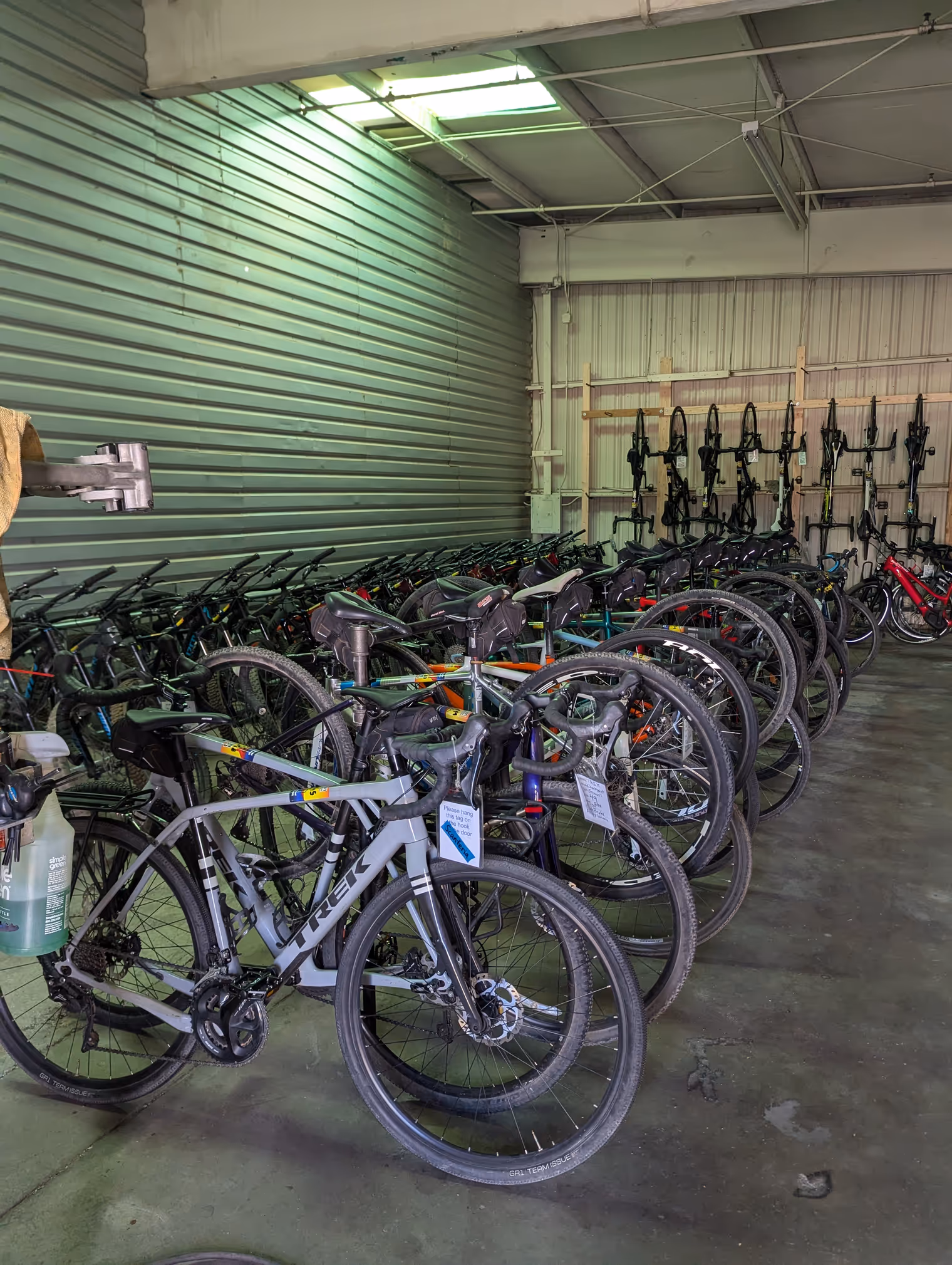
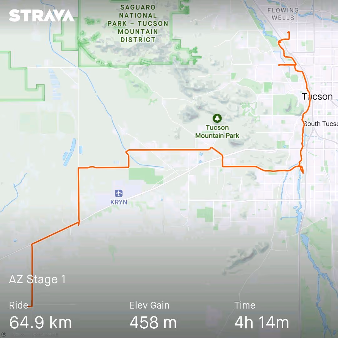
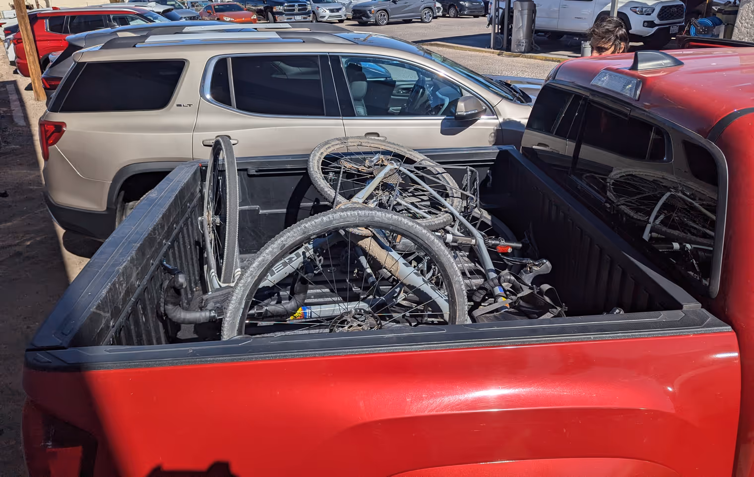
5:30 wake-up. We have to cut sleep short to catch the bus to Tucson at 7:25. It’s one of the famous Greyhounds, the silver buses that connect the continental United States. Ours departed last night from Los Angeles and will arrive in Dallas, Texas, this evening. A route of nearly 2,500 kilometers. We’re only getting off at the next stop though, after about two hours, in downtown Tucson. From there we take a taxi to the northern outskirts, to a “storage area,” a massive complex of small row garages used by individuals and businesses as warehouses for all sorts of stuff. It’s in one of these garages that we need to pick up our rental bikes.
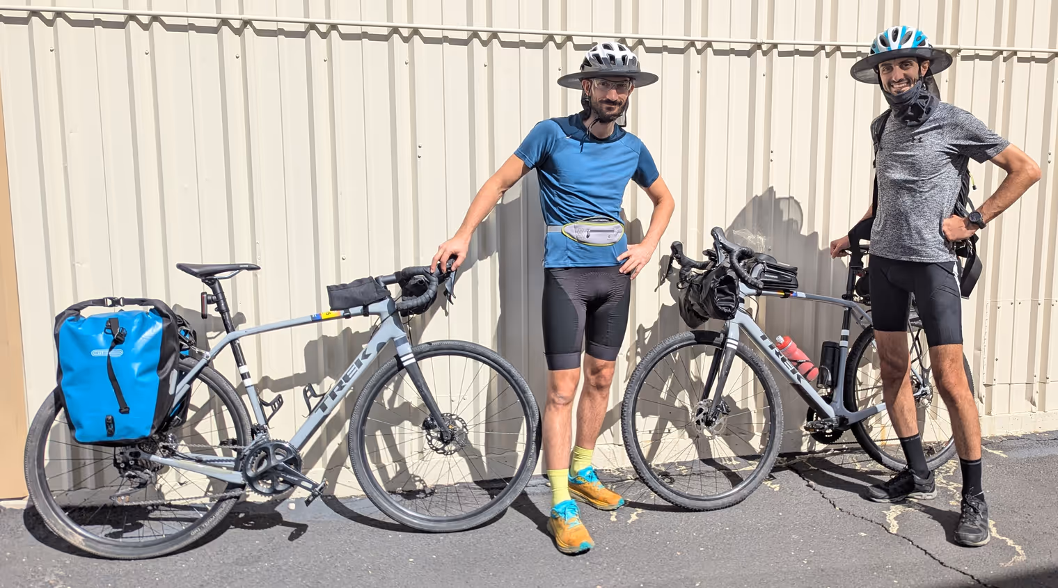
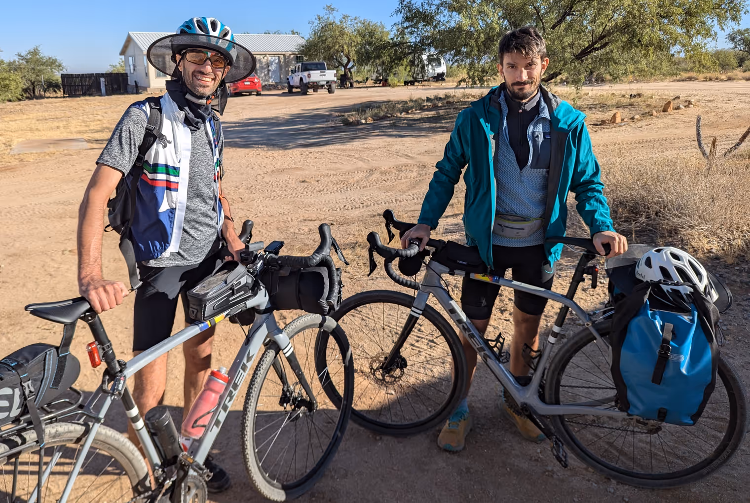
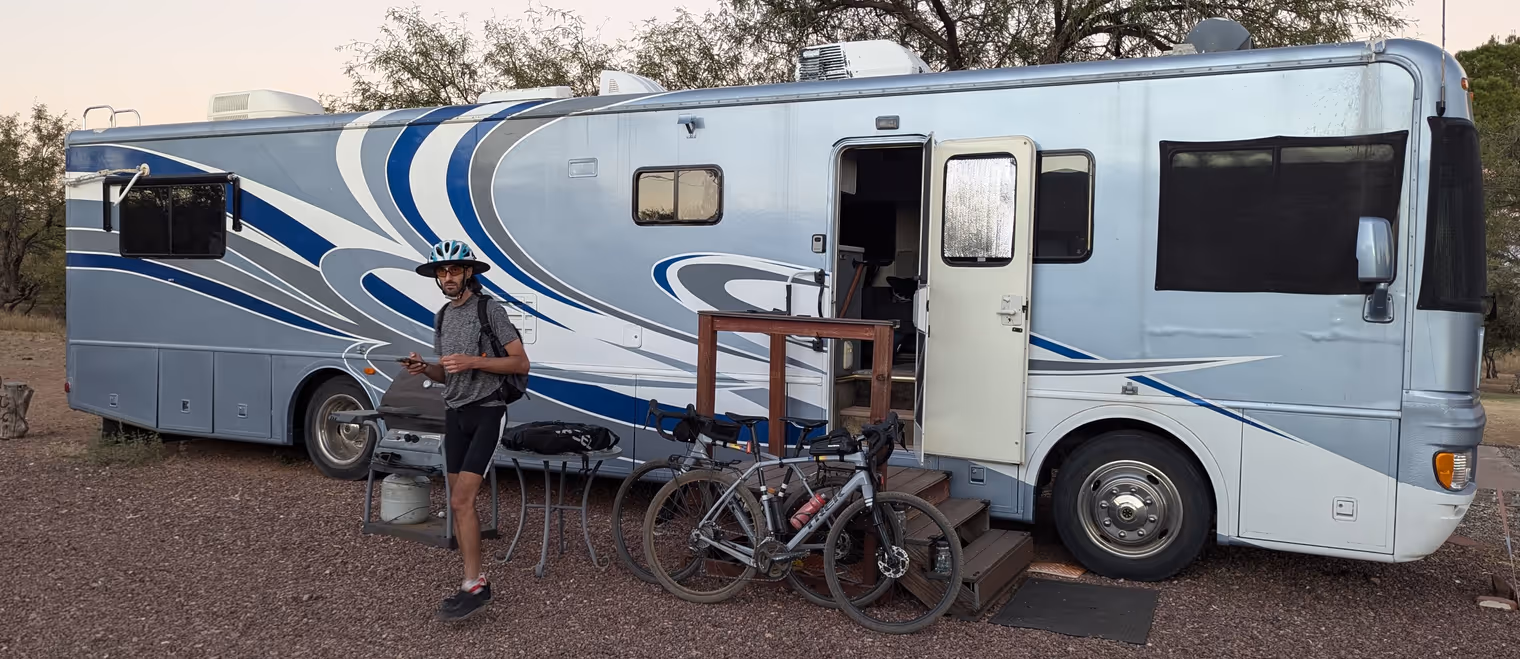
As a Tucson bike shop warned me, the rental manager, Pete, “is a good man, but eccentric.” I got a sense of this from our WhatsApp exchanges too, so Davide and I keep our fingers crossed that the bikes are actually there. Fortunately, they are. They even have the rear racks I requested. We don’t meet Pete in person, but we find the mechanic who services the bikes. A kind gentleman, who gives us some tips for the trip.
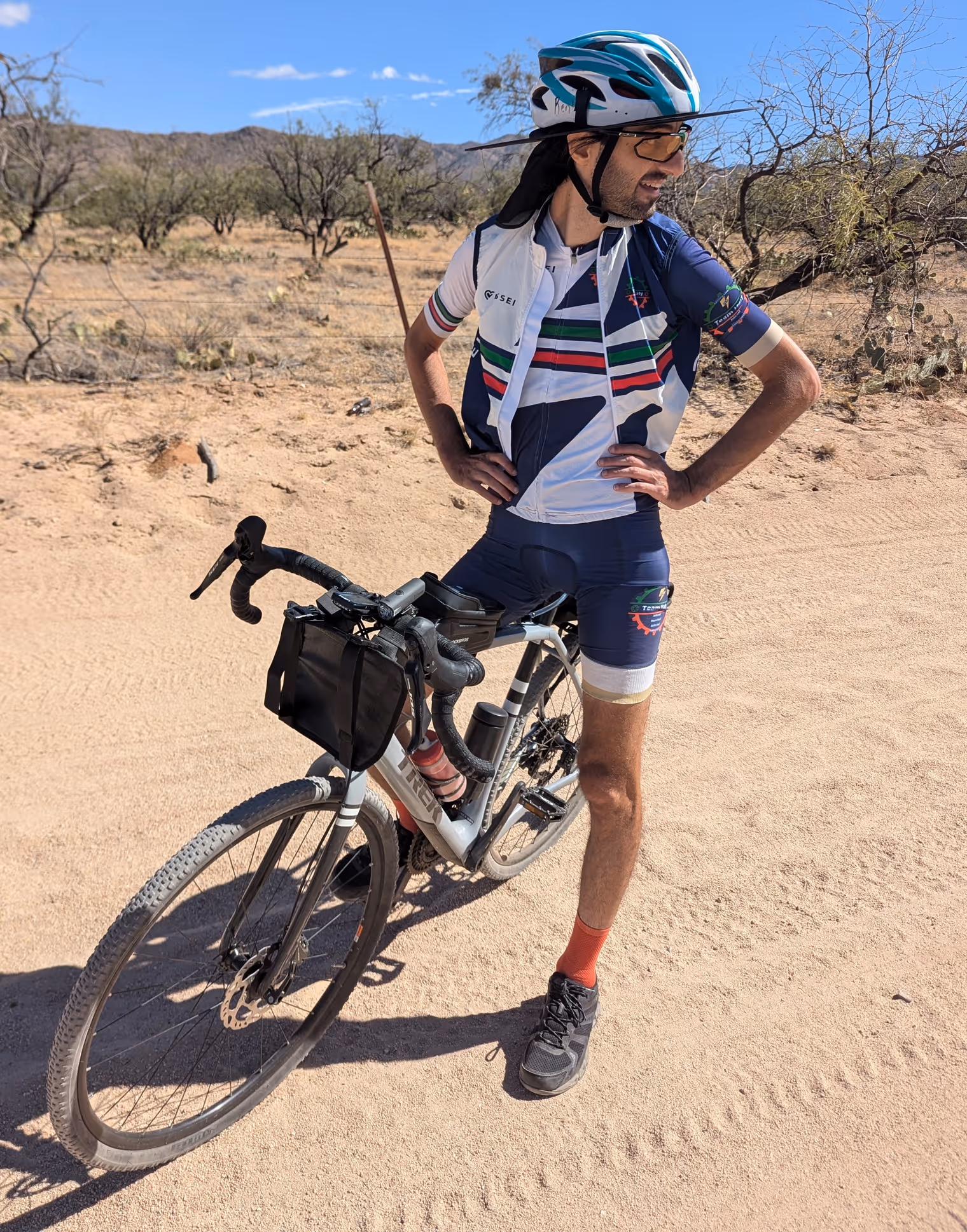
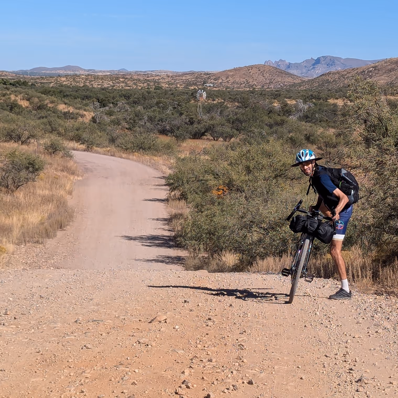
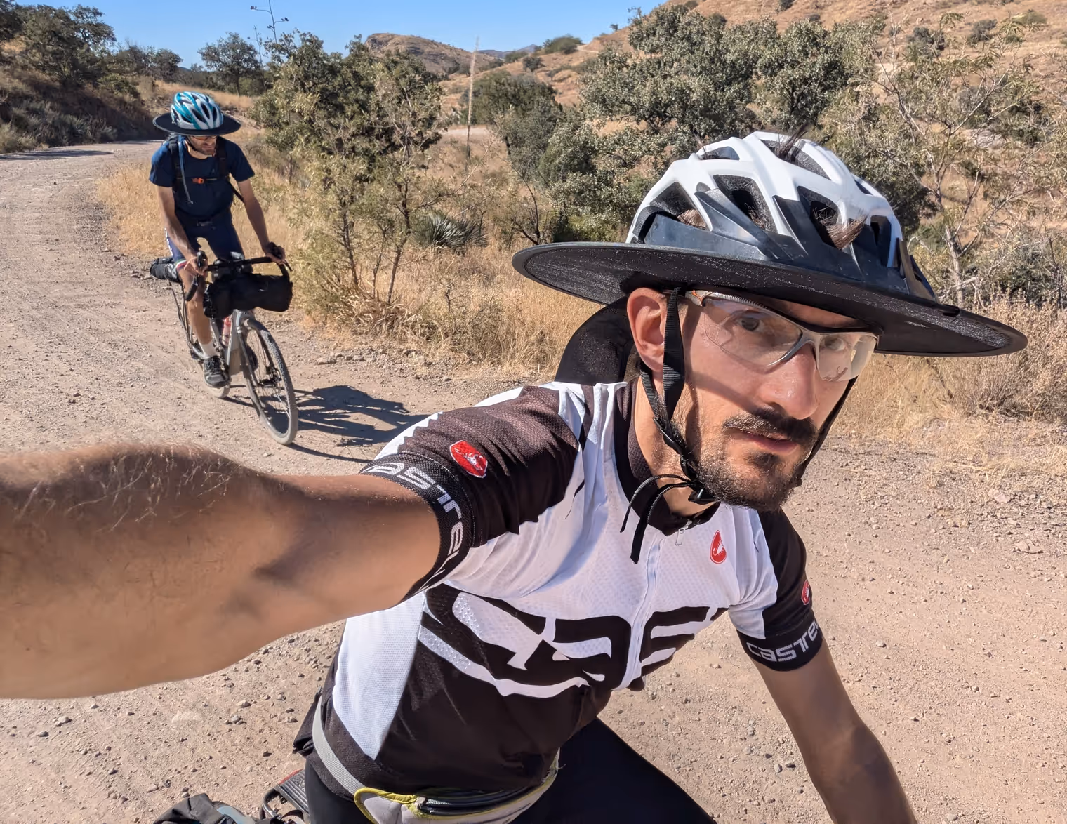
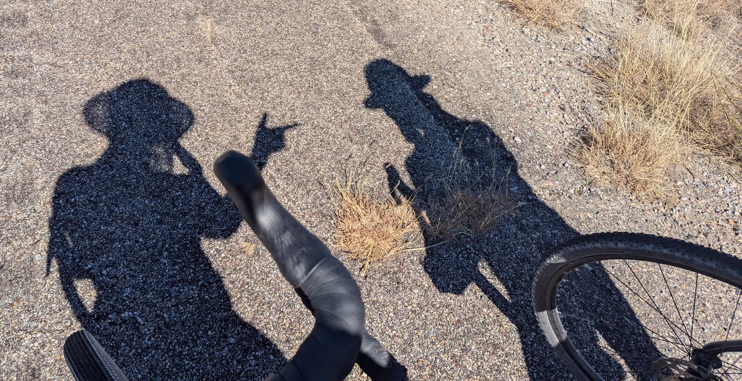
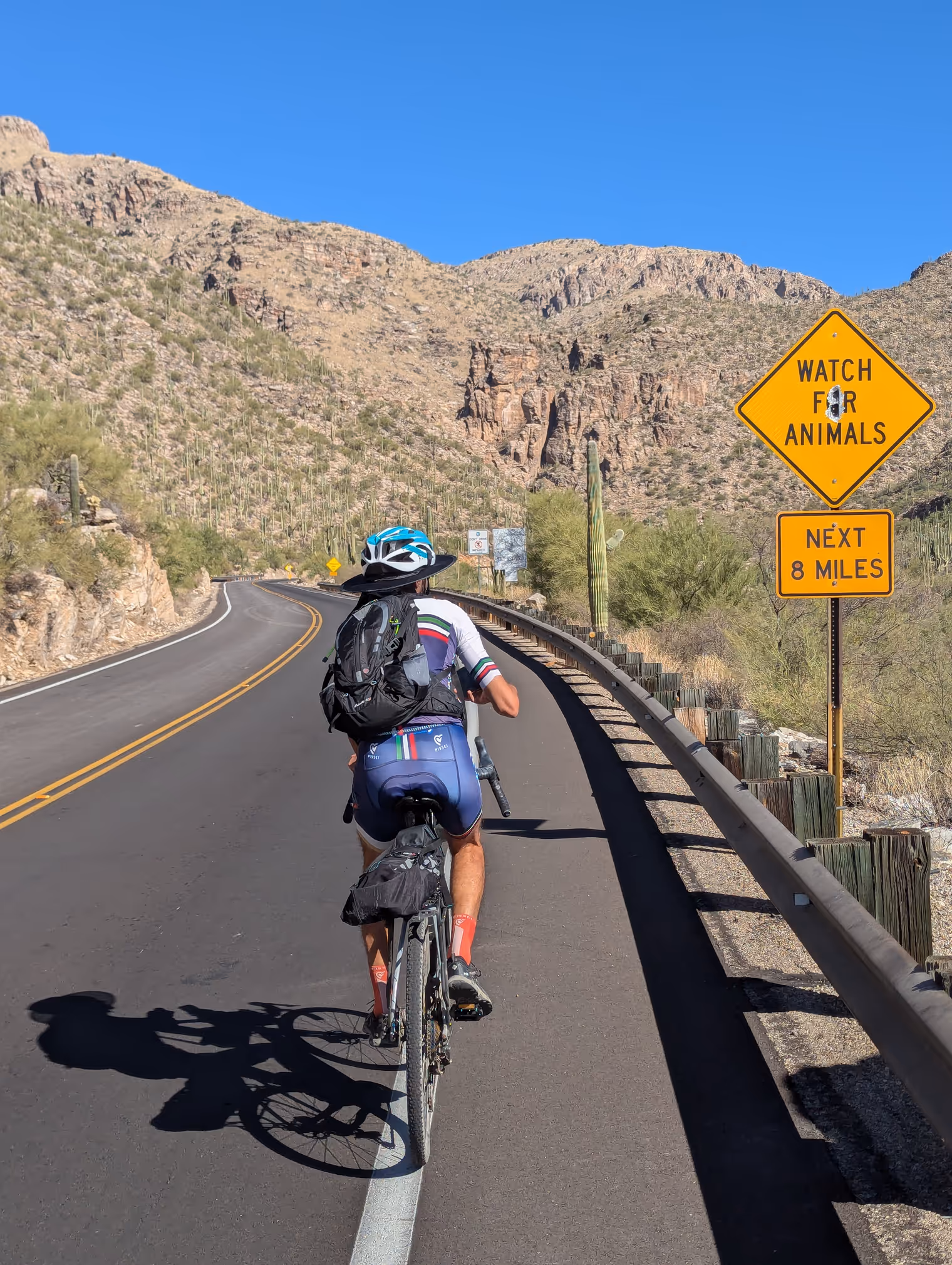
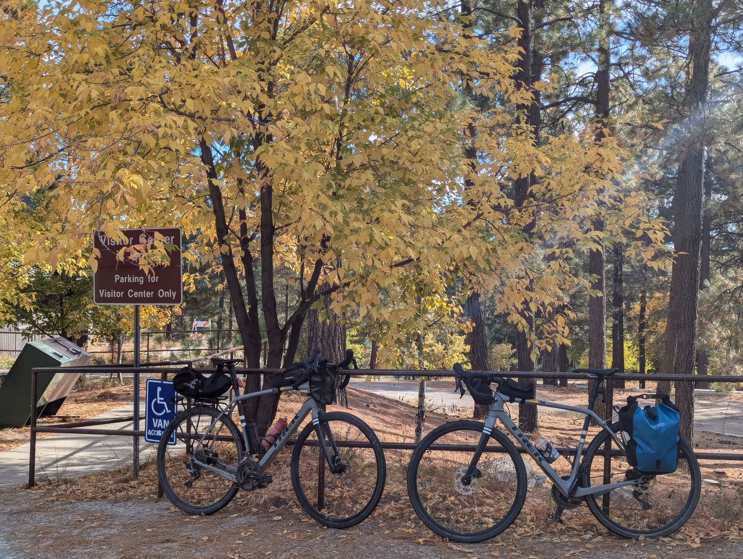
So, after loading everything onto the bikes and snapping a ceremonial photo, we set off on the first leg of the journey. For a laugh, Davide brought two mesh “sombrero nets” to clip onto our helmets. With them on we look like two dumb cowboys, but we soon realize the accessory is anything but a gag: in Arizona even in October the sun splits rocks, and something to cover face and neck is essential.
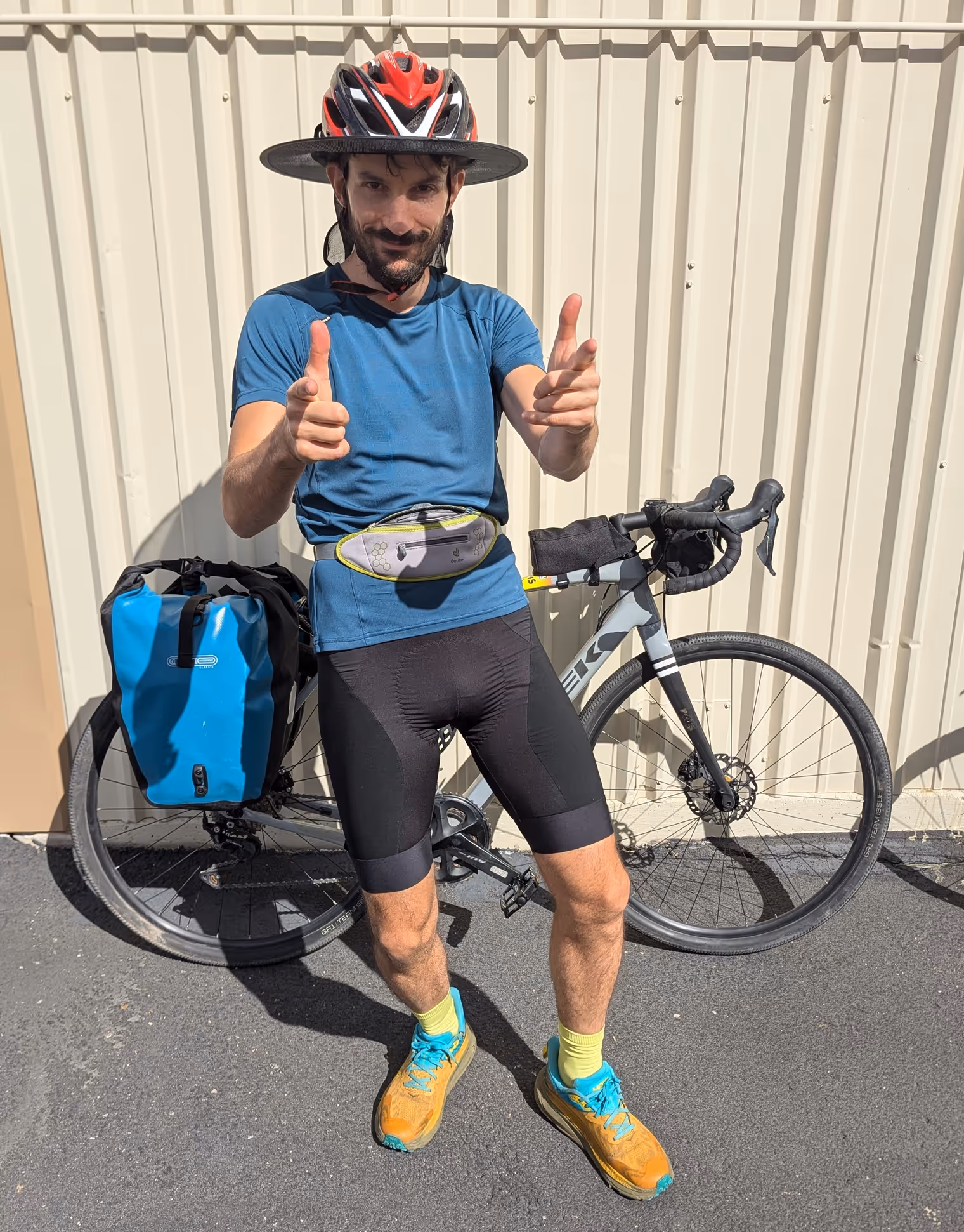
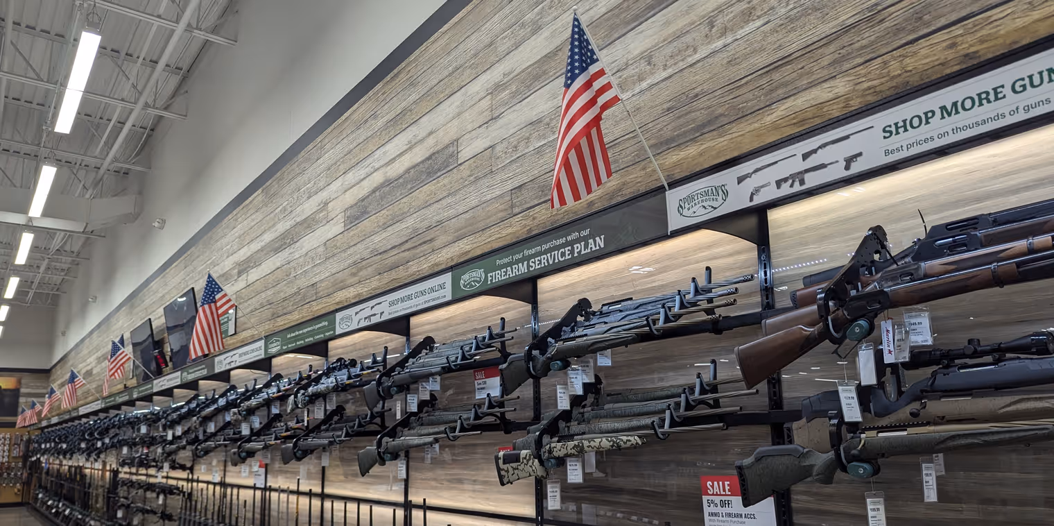
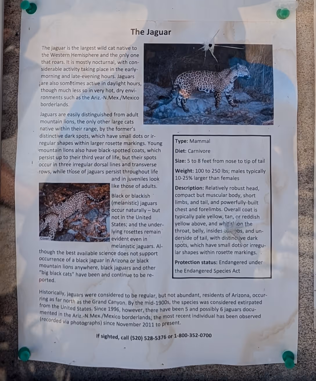
It’s already noon when we get moving, and we have to hurry if we want to arrive before dark. But first a crucial stop: a sporting goods store to buy bear spray. Our route will pass through areas teeming with bears, coyotes, cougars, and even jaguars. I don’t have much faith in the spray’s effectiveness in the event of an attack (which is highly unlikely anyway), but at least it gives me enough sense of safety to keep the paranoia at bay. In the store, of course, they sell pistols and rifles just as readily. An American would probably have bought those. I’m fine with the spray.
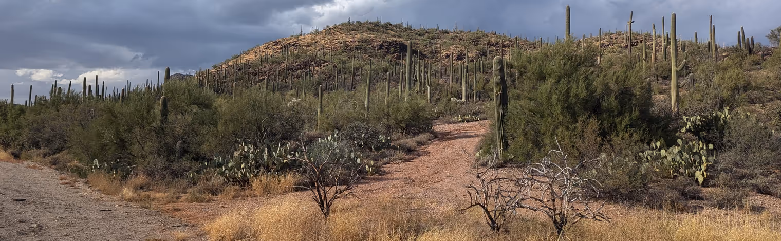
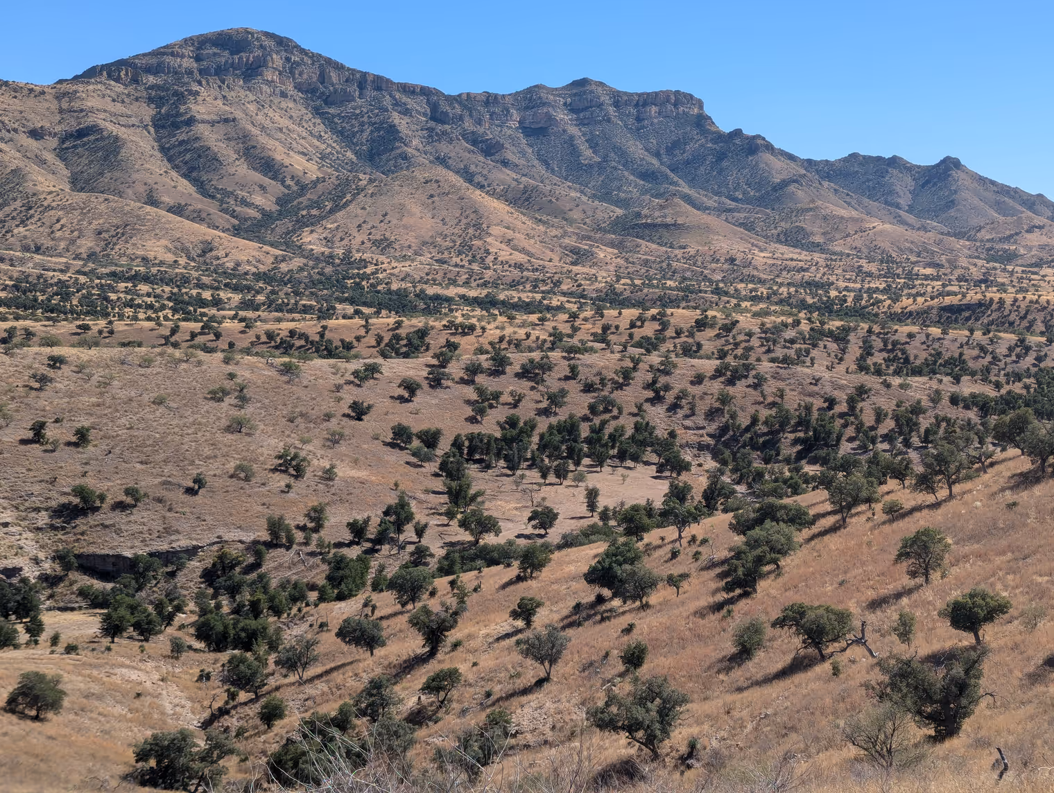
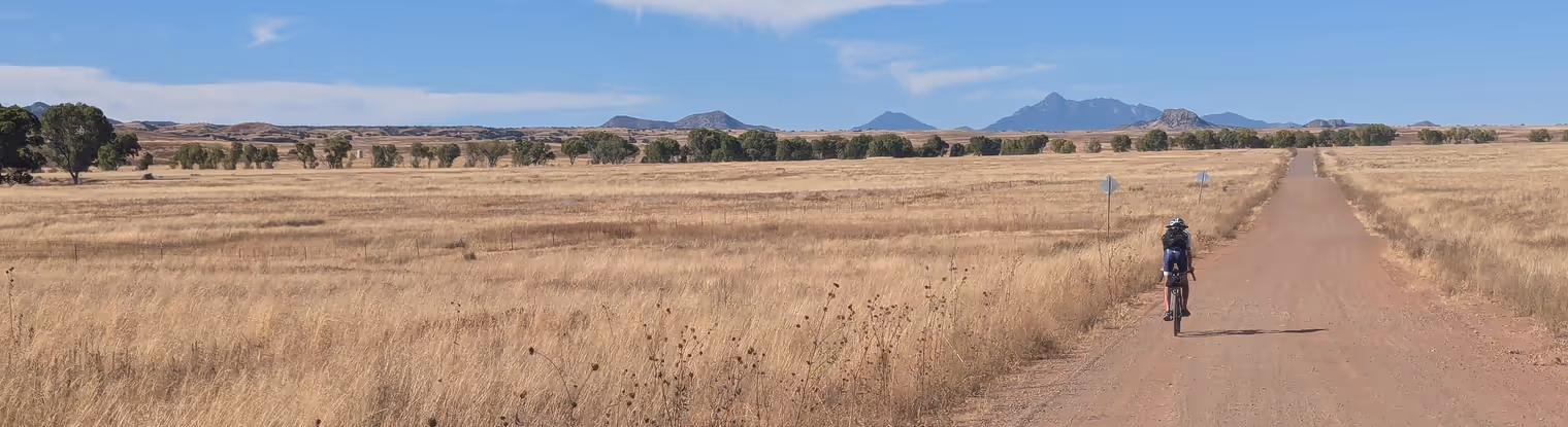
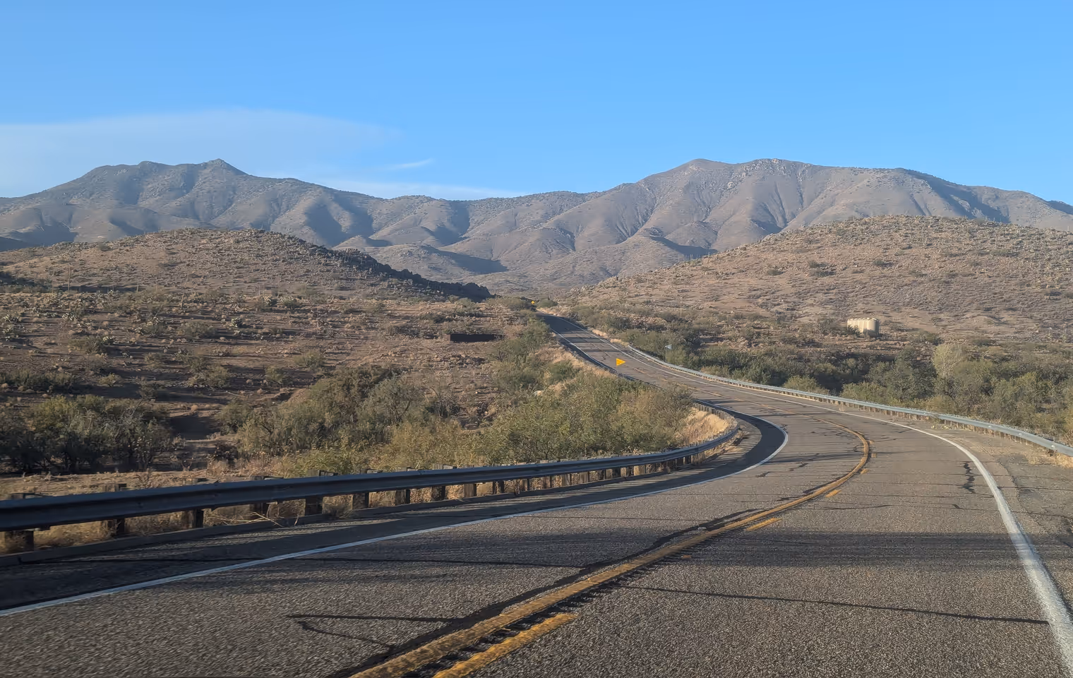
The road to the small town of Three Points isn’t great, but we have to get out of Tucson and are riding through its whole outskirts. We do, however, see our first saguaros, the classic multi‑armed desert cacti. The hillsides are carpeted with them, as if they were trees.
We stop at a small supermarket (small by American standards, of course) to buy dinner and breakfast. A lady in line at the checkout strikes up a conversation and offers us a roof for the night in case we have nowhere to sleep (no ulterior motives, she’s quick to clarify). It confirms the stereotype of American kindness and hospitality, which I’ve experienced other times in the past.
We do already have a place to sleep though: a bed and breakfast in the middle of the desert where we arrive shortly after sunset. But I’m writing too much for today. I’ll talk about it tomorrow.
Day 2: toward Keystone Peak
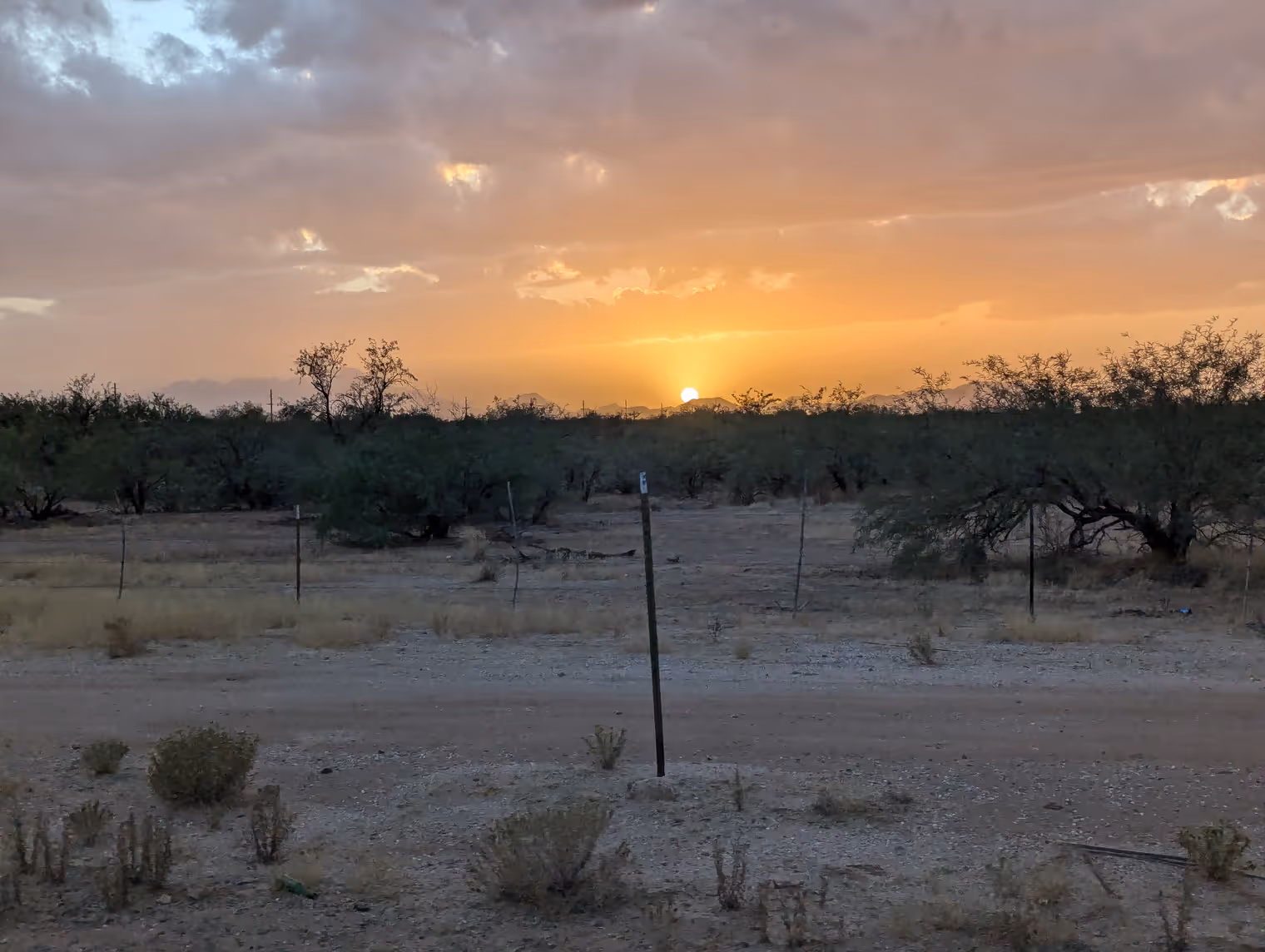
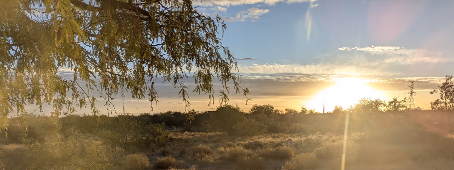
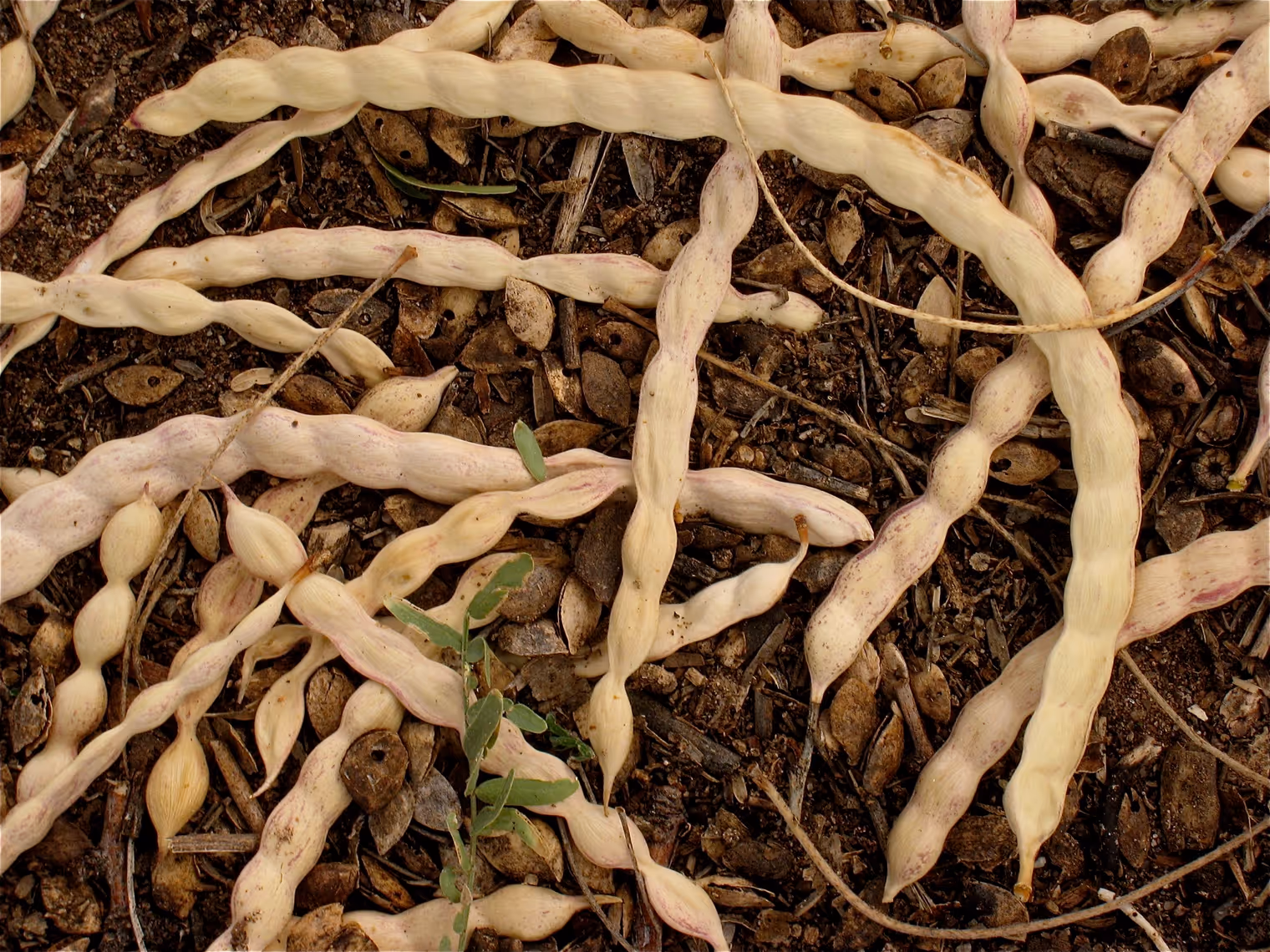
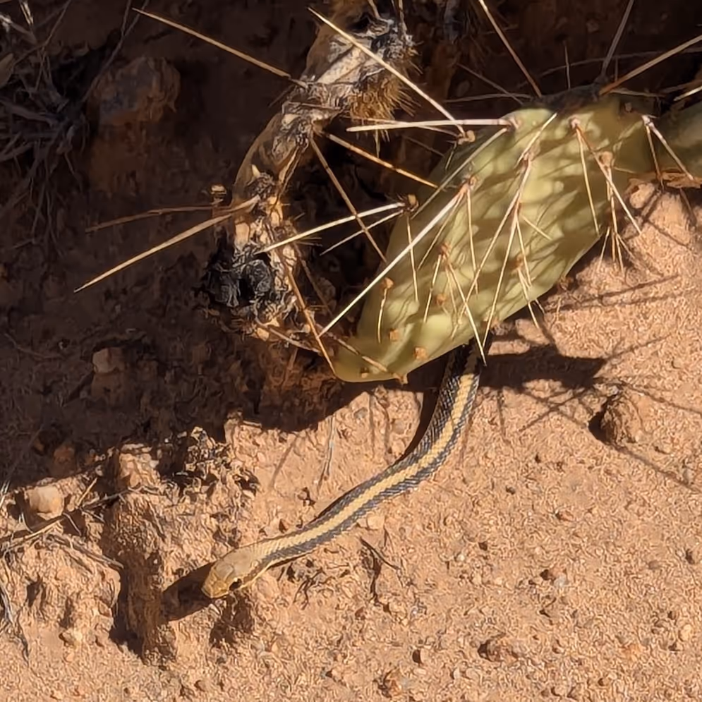
We wake to the low sun on the horizon tinting the landscape outside our room in gold. It’s a desert, yes, but it’s far from lifeless. Vegetation abounds: cacti, of course, but also shrubs and short trees. One of them, the mesquite, litters the ground with yellow pods that look like beans, from which locals make a rich, tasty flour. Then there’s a variety of animal species that survive in this ecosystem: snakes, scorpions, quail, roadrunners (like the one from the Wile E. Coyote cartoon), deer, pronghorn, coyotes, cougars, and even a few jaguars. For most of the year there’s no water; no rain and no rivers, but nature adapts.
The hosts at the bed and breakfast are Linda and Kevin, two transplants from Rhode Island (a small state northeast of New York) who have found peace on this five‑acre plot in southern Arizona. They’re extremely hospitable, and very talkative too. After breakfast they entertain us for a good hour, telling us about their life in this unusual environment and giving us a glimpse into the local reality.
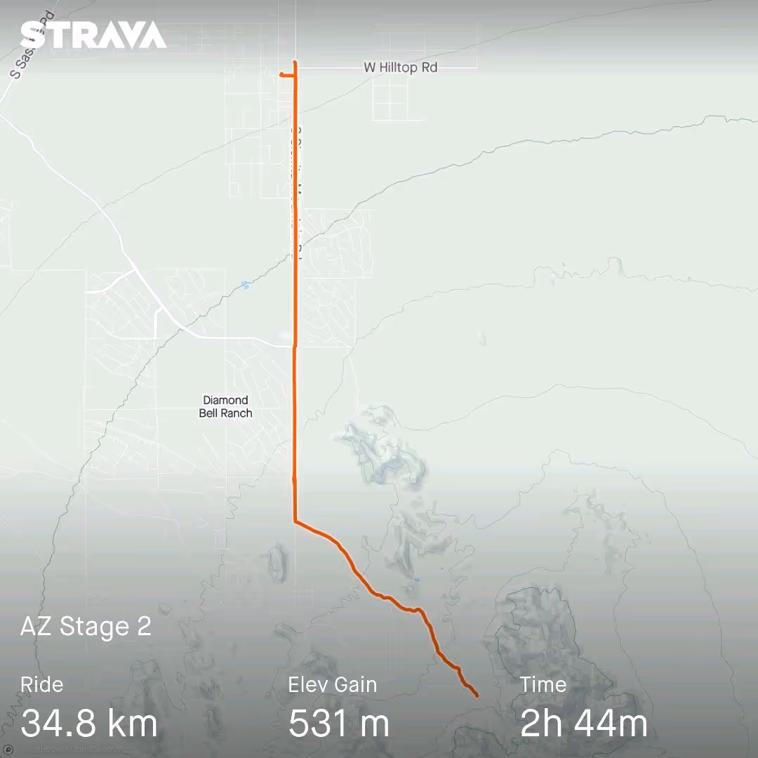
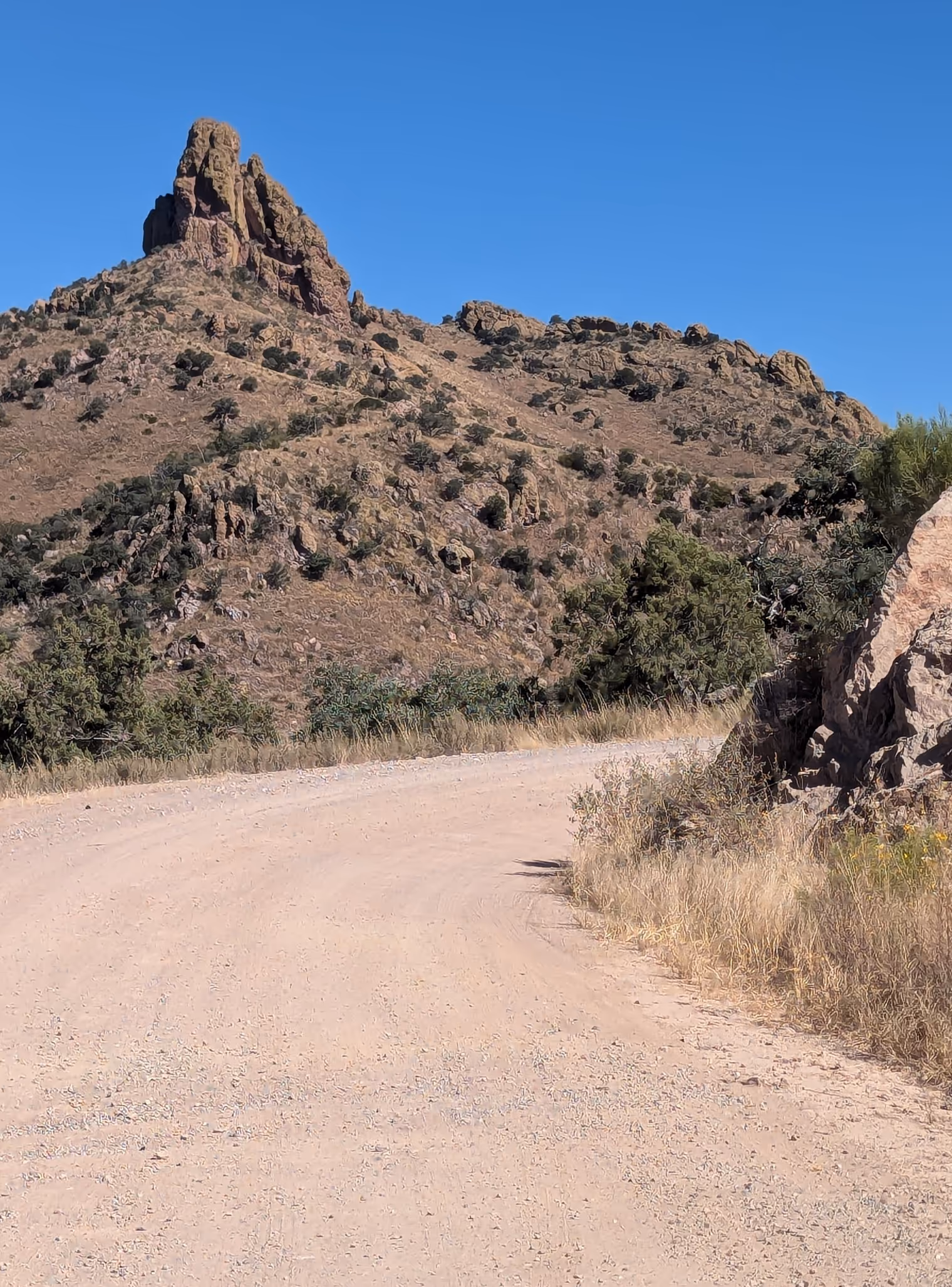
Today’s plan was to climb a mountain “nearby,” Kitt Peak, a popular scenic destination and home to an astronomical observatory. But “nearby” here is relative. It’s about 110 kilometers (including 50 on a fairly busy road), with 1,300 meters of elevation gain. I’m recovering from an injury to my left knee, and yesterday at the end of the ride I felt an annoying twinge; not in the critical spot of the injury, but I still need to be careful. We decide to scale back our ambitions, and set out on a shorter outing toward Keystone Peak, just 30 kilometers from the BnB.
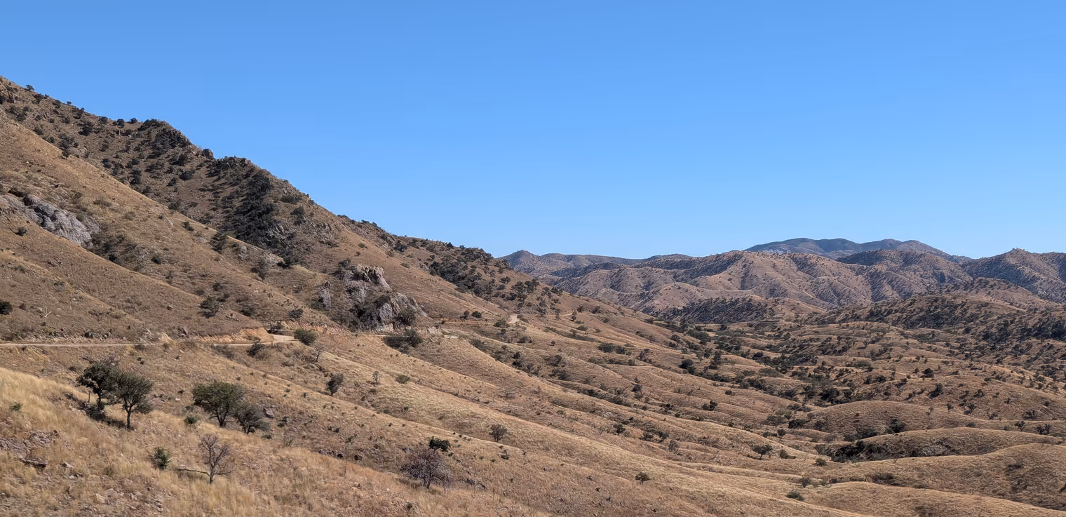
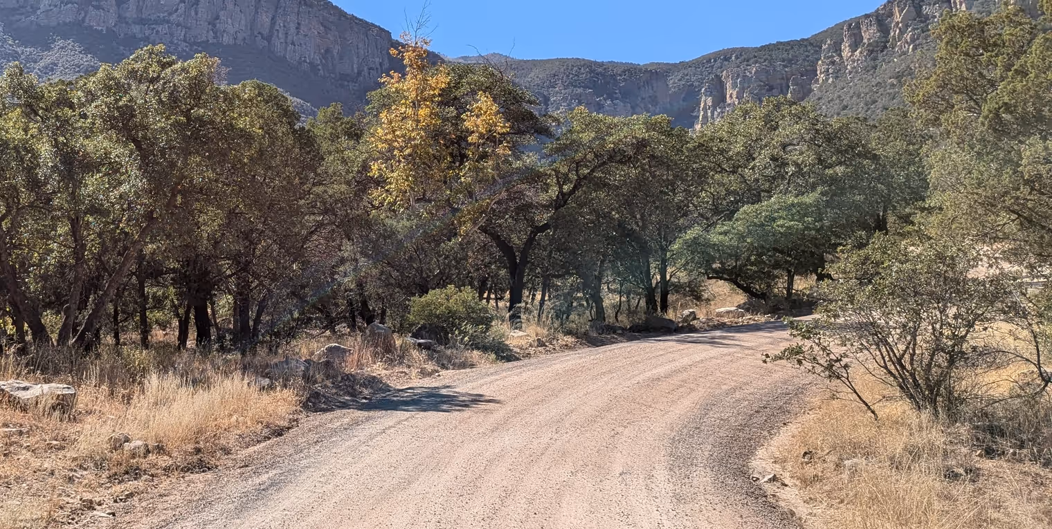
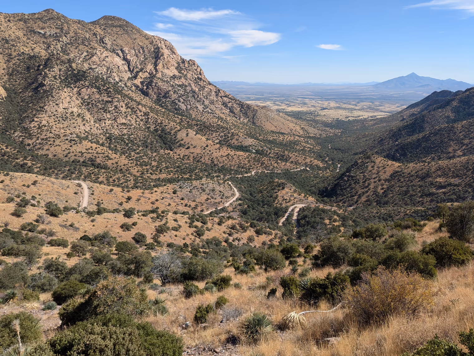
The first stretch is on pavement and rolls easy. When the dirt begins, though, we start panicking. It’s very “washboarded” gravel, with ruts left by heavy vehicles (tractors, pickups) that make pedaling inefficient and incredibly uncomfortable. In some sections we also find deep sand where we can barely move; the wheels sink and jam, and we often have to get off and push. After an hour of effort, we’ve covered just over 5 kilometers. If all of Arizona is like this, we’re in trouble. We need to reconsider our route stages.
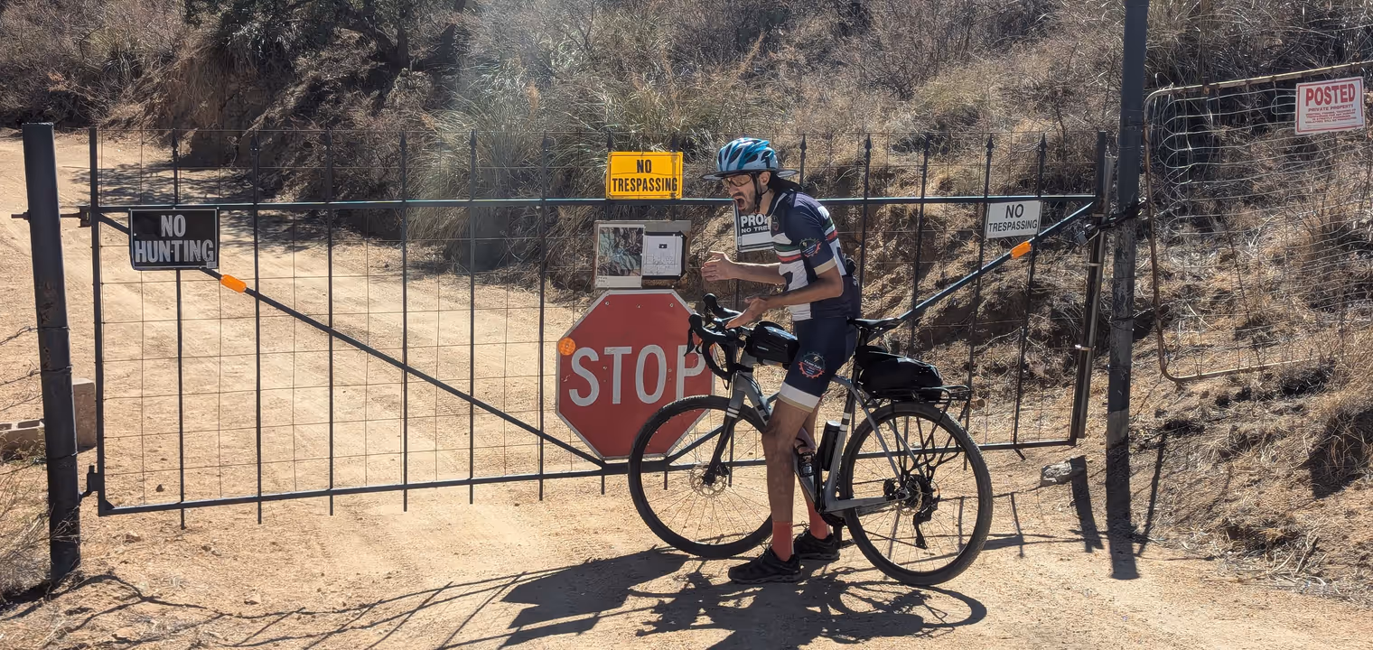
But there’s another problem. About ten kilometers from the top, the road is blocked; stop, private property, “no trespassing”! What do we do? The barrier is easy to bypass, but in Arizona it’s perfectly legal to shoot someone who enters your property without permission. We don’t want to risk it, so, with some disappointment, we turn back. I don’t mind resting my knee anyway, and Davide is still feeling the jet lag. A short day suits us just fine.
It’s interesting to note the paradoxical contrast between the spontaneous hospitality and affability you perceive in day‑to‑day interactions and the acceptance of the doctrine that yes, if you step into my yard, I’m justified in shooting you.
In the evening Linda and Kevin invite us to have dinner with them. Linda has prepared a delicious bison meatloaf, which we devour with enthusiasm. They tell us more stories from their life, and the tale of what led them to move to Arizona. They insist that Davide and I look incredibly alike. If not twins, we must at least be brothers. No, I reply, we’re really just both Italian.
Day 3: descent to Arivaca
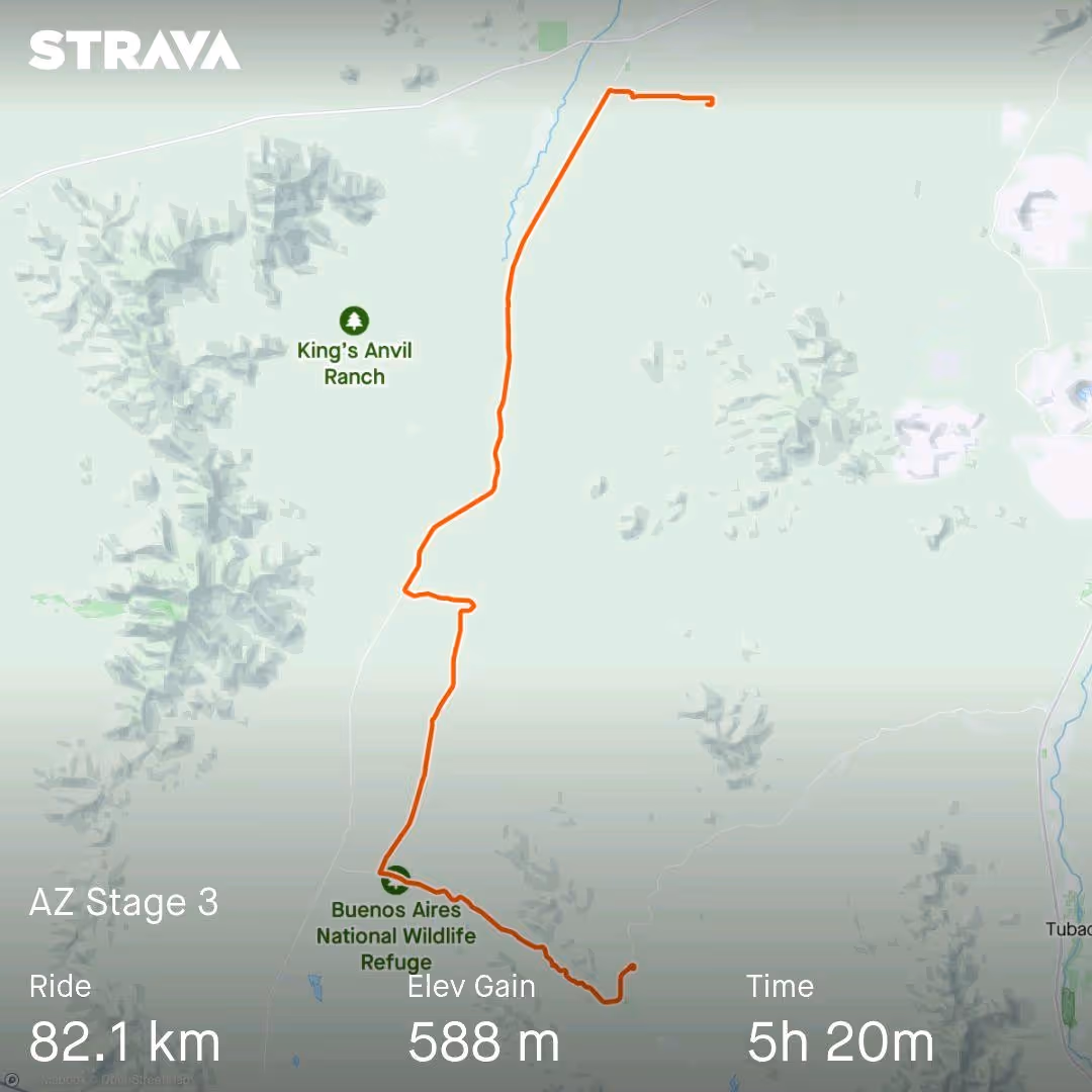
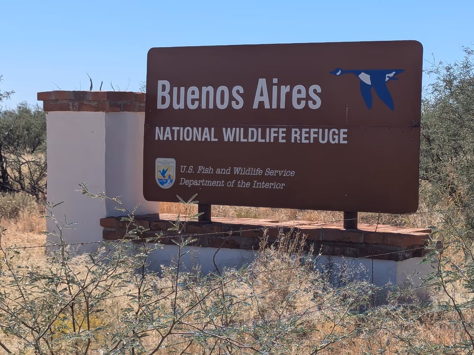
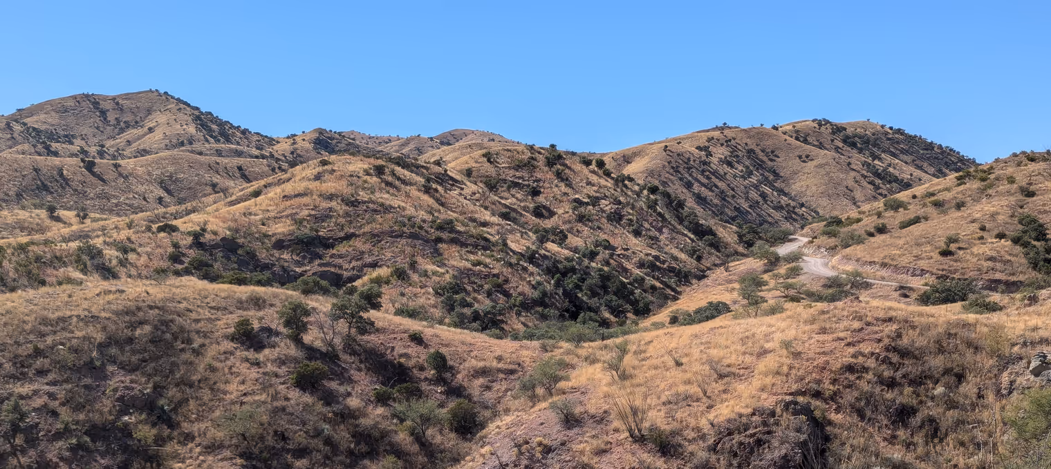
We’ve revised today’s route. The general plan is to head south for about 60 kilometers, then turn east for another 20, and arrive in the small town of Arivaca. Initially we thought we’d use a web of dirt tracks that seem to connect Three Points with the territories further south, but, given yesterday’s experience, we changed our mind. We’ll ride the main (paved) road for about thirty kilometers, and only then, at the start of the Buenos Aires National Wildlife Refuge, we’ll hop onto dirt. On Strava (a social network for cyclists) we saw that the dirt roads from that point on are indeed used by some intrepid riders, so we trust they’re rideable.
Fortunately, they are. Yes, there are some washboard ripples and a bit of sand at the seasonal crossings (now dry), but for the most part the surface is easy and very enjoyable. The scenery is delightful too; we’re climbing up the Altar Valley, and rows of rocky mountains accompany us along the way.
We stop for lunch in a small clearing. The sun beats down hard, and the temperature hits 32 degrees. We try as best we can to use the shade of a small mesquite tree. Before sitting on the ground, I carefully check for rattlesnakes or scorpions. Then I think better of it: I eat standing up. Davide isn’t as skittish and enjoys the break in comfort.
It feels a bit strange to be here with him. Not that it’s awkward or clumsy—quite the opposite. It’s just surprising to think we ended up here, in the middle of nowhere, him coming from Japan and me from Lithuania. In two weeks we’ll go back to our homes, and who knows when we’ll see each other in person again. Modern friendships.
We ride into Arivaca late in the afternoon and stop for an early dinner at the town’s only restaurant. The menu is entirely Mexican, but then again we’re only a few kilometers from the border. Taco, quesadilla (a cheese-filled flatbread), and a tomato soup. I ate too much, but I’m satisfied. Tonight’s bivouac is a camper set up as a BnB. Not very comfortable, but certainly interesting.
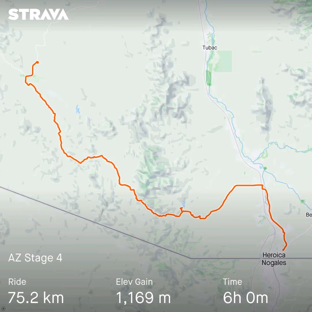
Day 4: Ruby Road
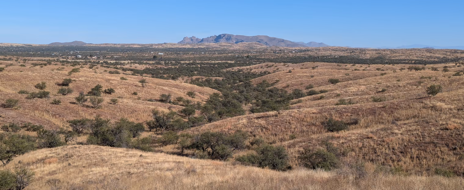
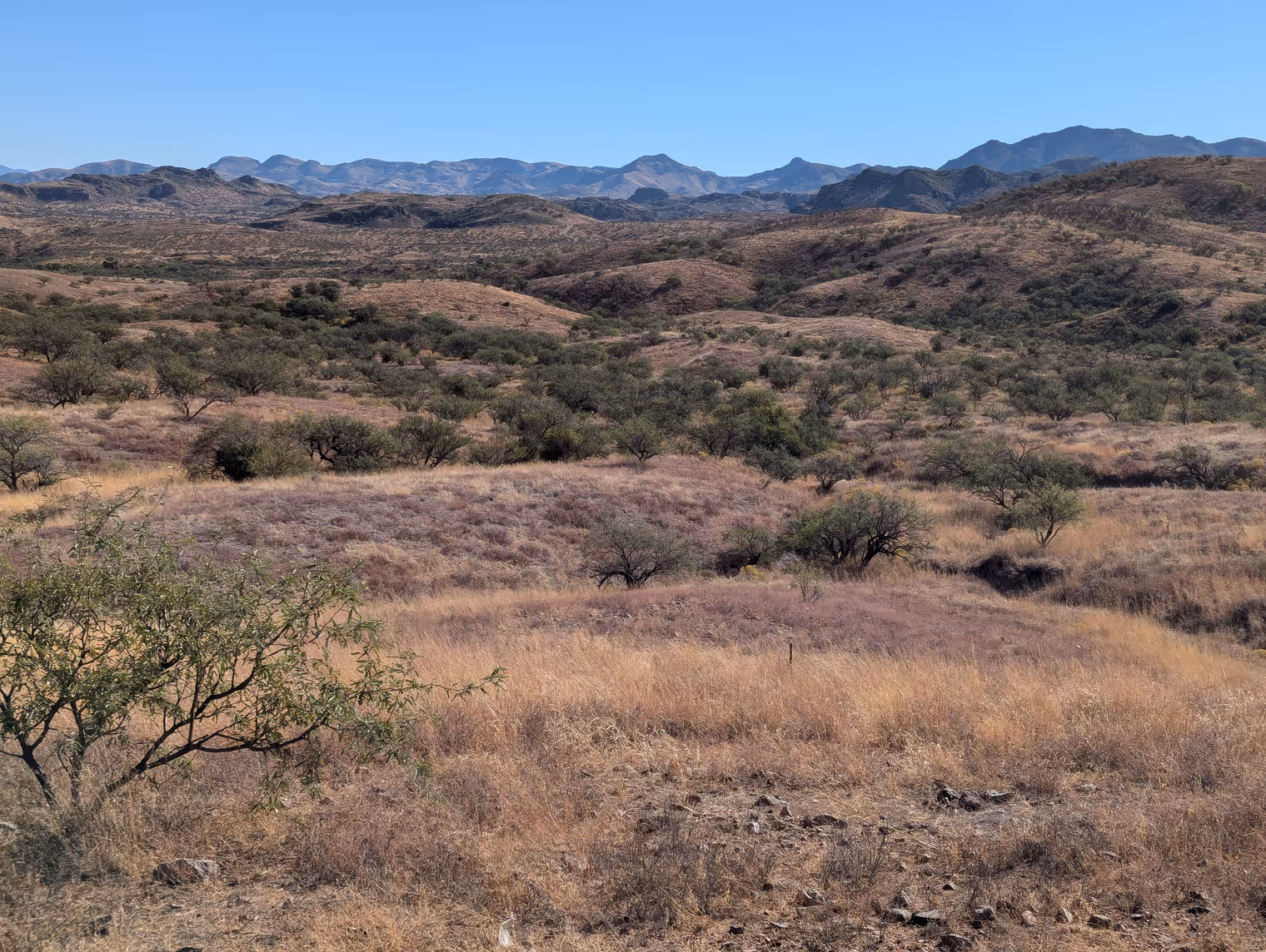
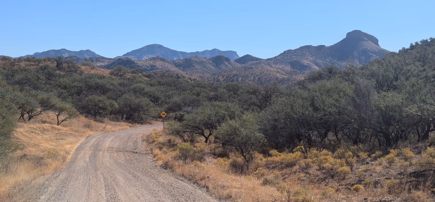
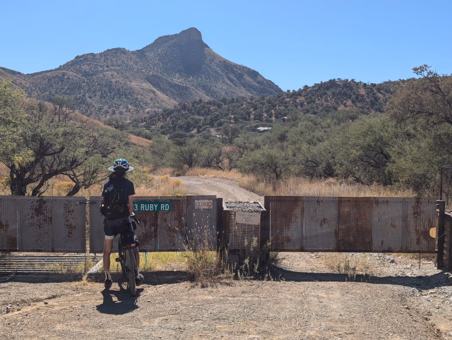
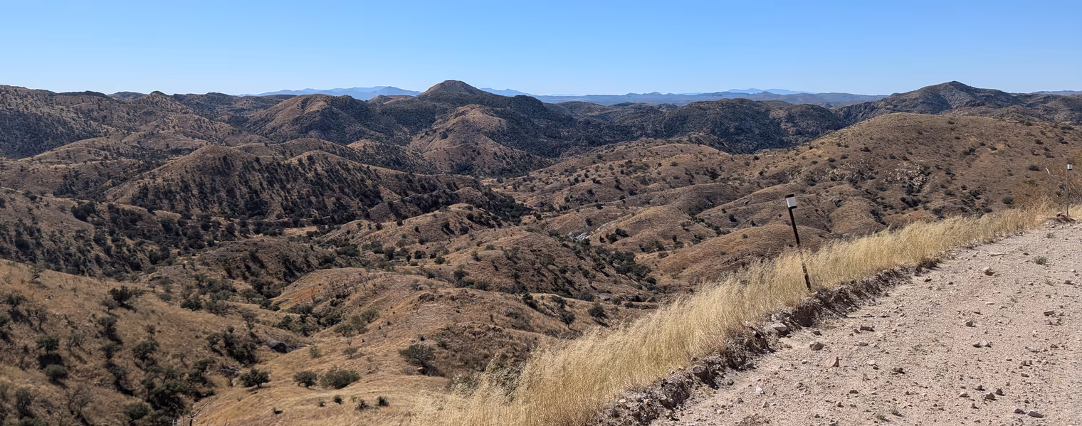
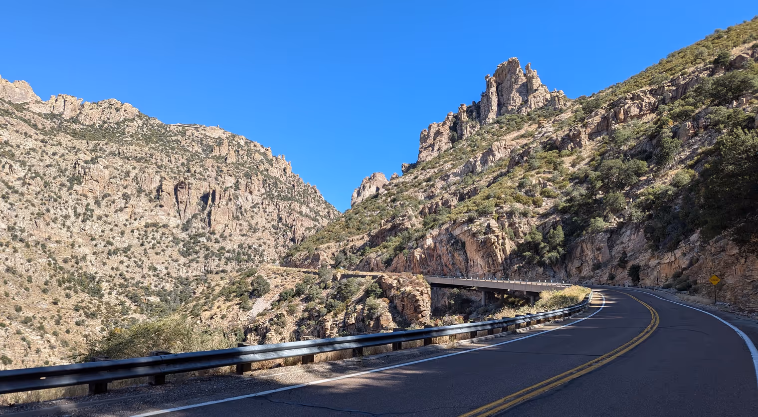
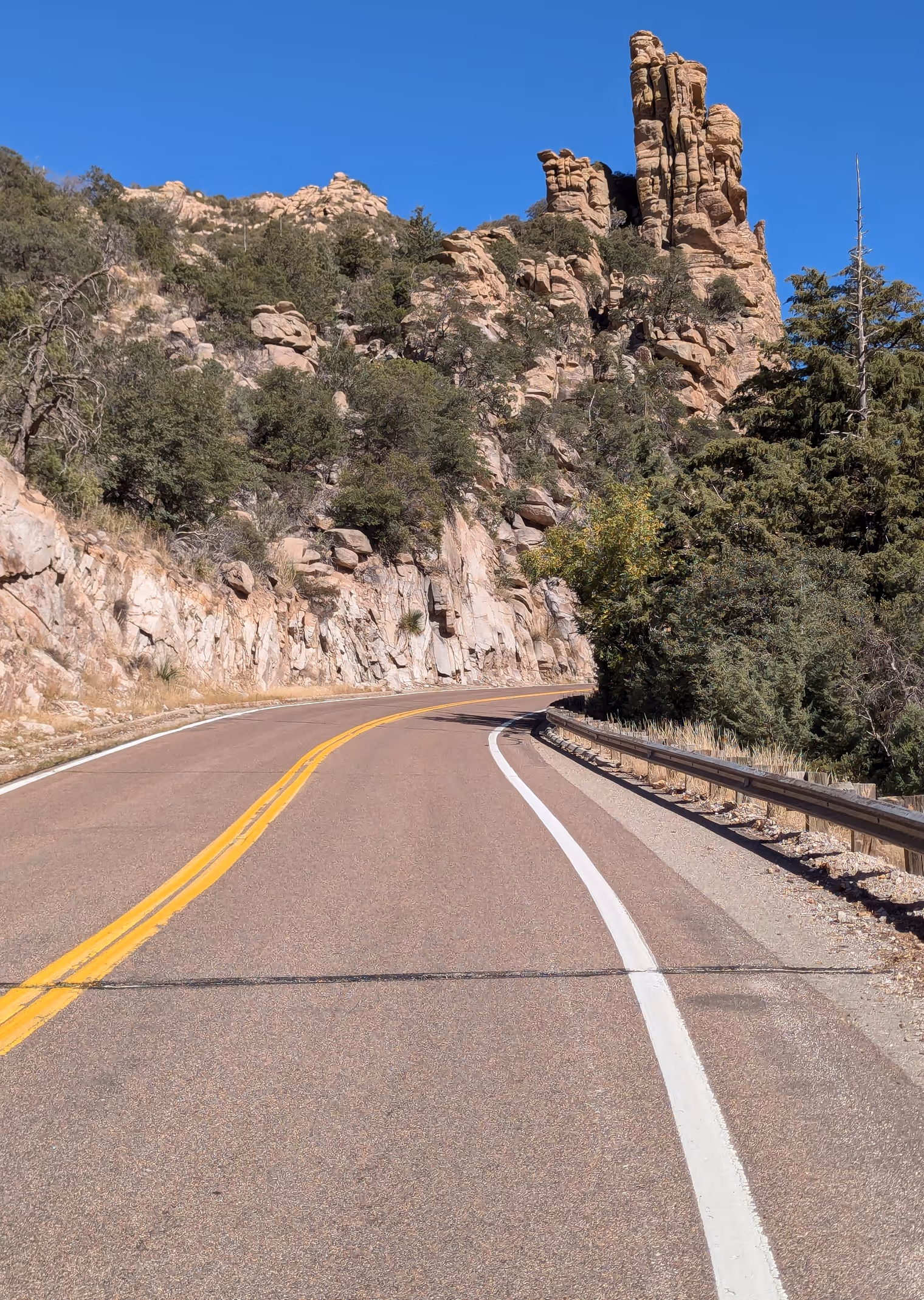
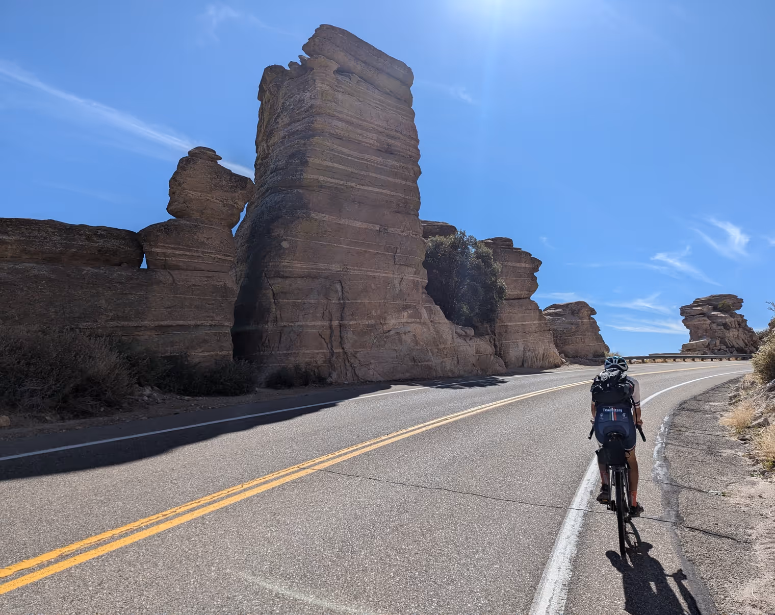
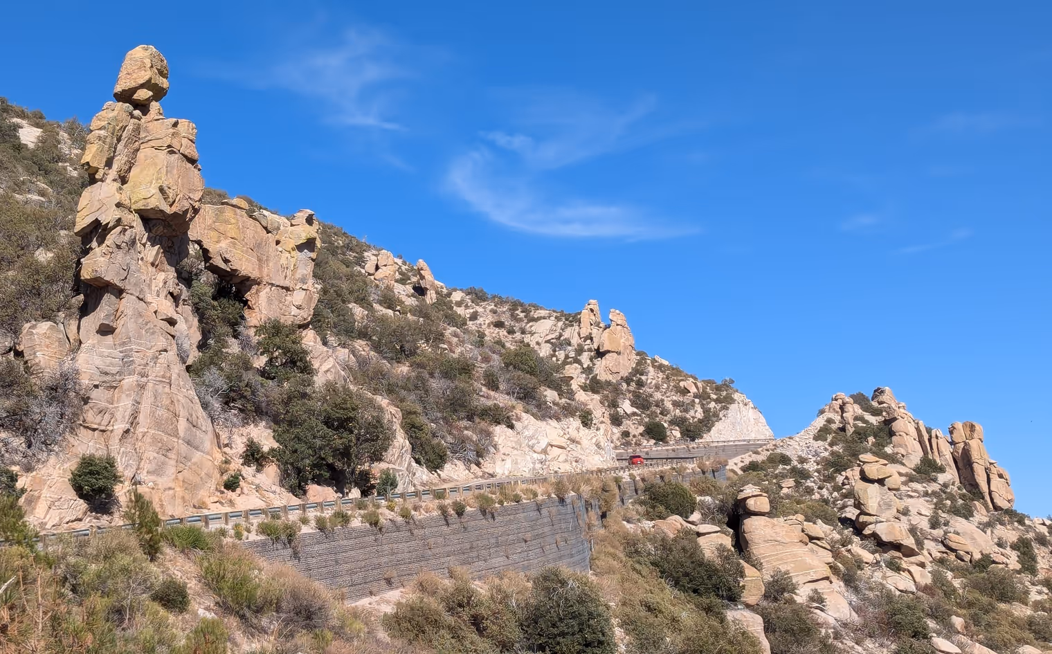
Today will be a tough one. We’ll cut southeast toward the border town of Nogales, crossing a mountain group that stretches some thirty kilometers across. The total distance is about 75 kilometers; all ups and downs, 80% dirt. We’ll mainly be on Ruby Road, so called because it passes the abandoned mining town of Ruby, once a focal point for gold, silver, copper and other metal extraction.
The road begins by climbing a ridge; hard work, but with sweeping 360‑degree views right away. It then dives into the thick of the mountains, which shut us off from the rest of the world. We don’t see anyone pass, except for a couple of white‑and‑green Border Patrol pickups patrolling the area as a deterrent to smuggling. Our phones show no signal at all. I take the opportunity to test the satellite radio I bought a few weeks ago. I send a message to Goda, who replies after a few minutes. Perfect; everything works. If a cougar eats me I can call for help.
When we reach the little road that descends into the center of Ruby, we discover it’s blocked too; no trespassing. We stop outside the gate and have a lunch of hard‑boiled eggs and jerky.
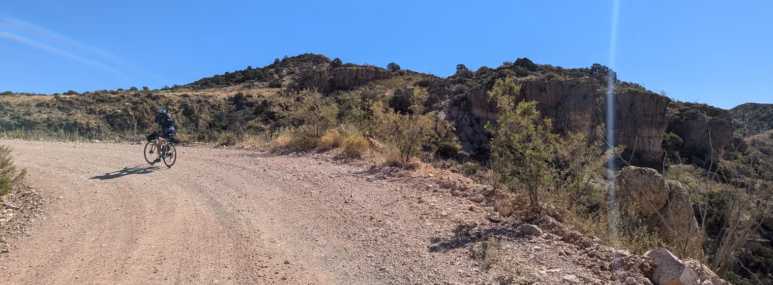
We resume under the midday sun, following with effort the road as it snakes through gullies, basins, and plateaus. It’s gorgeously scenic though, and my mind drifts into a western. I can almost hear Ennio Morricone echo through the valley. Ah no—that’s Davide who’s started whistling. I join in too.
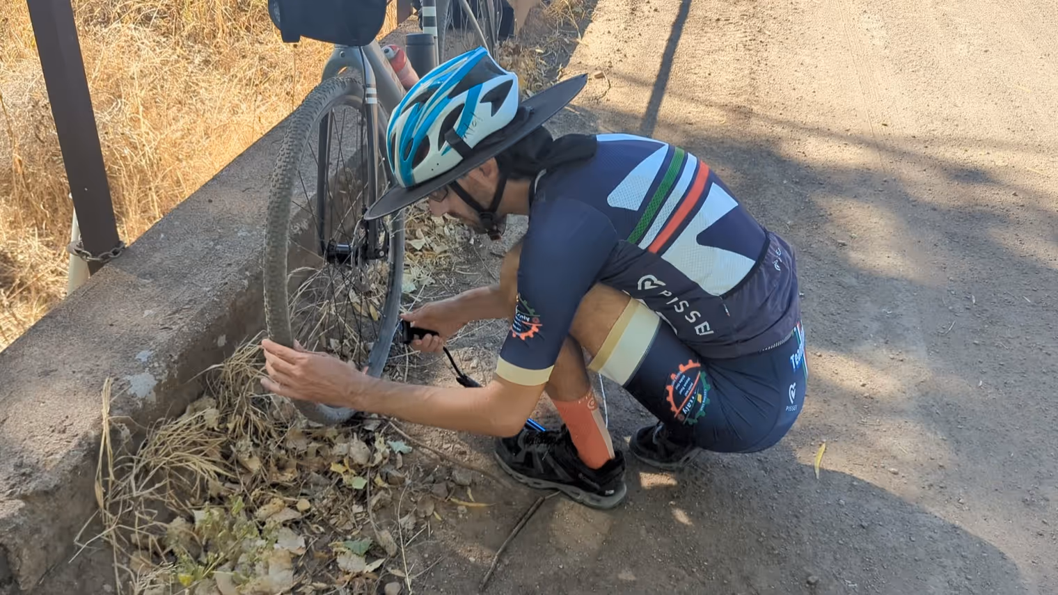
To reach Nogales we have to do one last short stretch on a very busy road. To stay as far as possible from the cars whipping by, we move onto a sort of sidewalk on our right, but we roll into a median planted with puncture vine—little woody balls covered in spikes. I realize it when my front tire starts hissing and spraying a white liquid. It’s a sealant that repairs punctures, and indeed after about ten seconds the hiss and spray magically stop. I pull over to assess the situation and, with horror, see about twenty of those spiky seeds stuck in both the front and the rear tire. I pull them out one by one, and each time the same scene repeats: hiss and liquid for a few seconds, then it stops, tube repaired. What technology! It reminds me of scenes from the sci‑fi series Foundation, where nanobots in the emperor’s blood heal every kind of wound in seconds.
We arrive quite beat, but we have a formula to repair ourselves too: shower, fried chicken, and eight hours of sleep.
Day 5: Patagonia
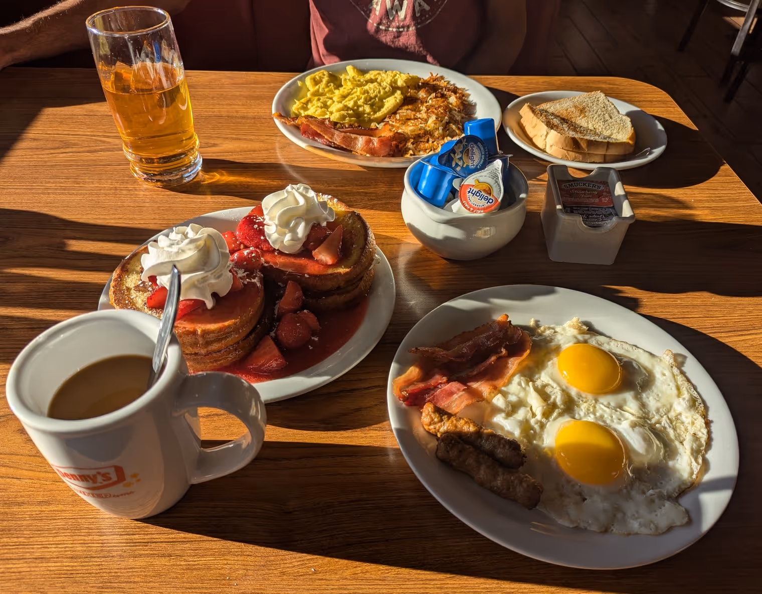
Across from our motel there’s a Denny’s. It’s the classic American diner: neon‑tube signage, a counter with a row of stools in front, and booth tables with benches for seats. The breakfast they serve is really overabundant, but we have no trouble finishing it.
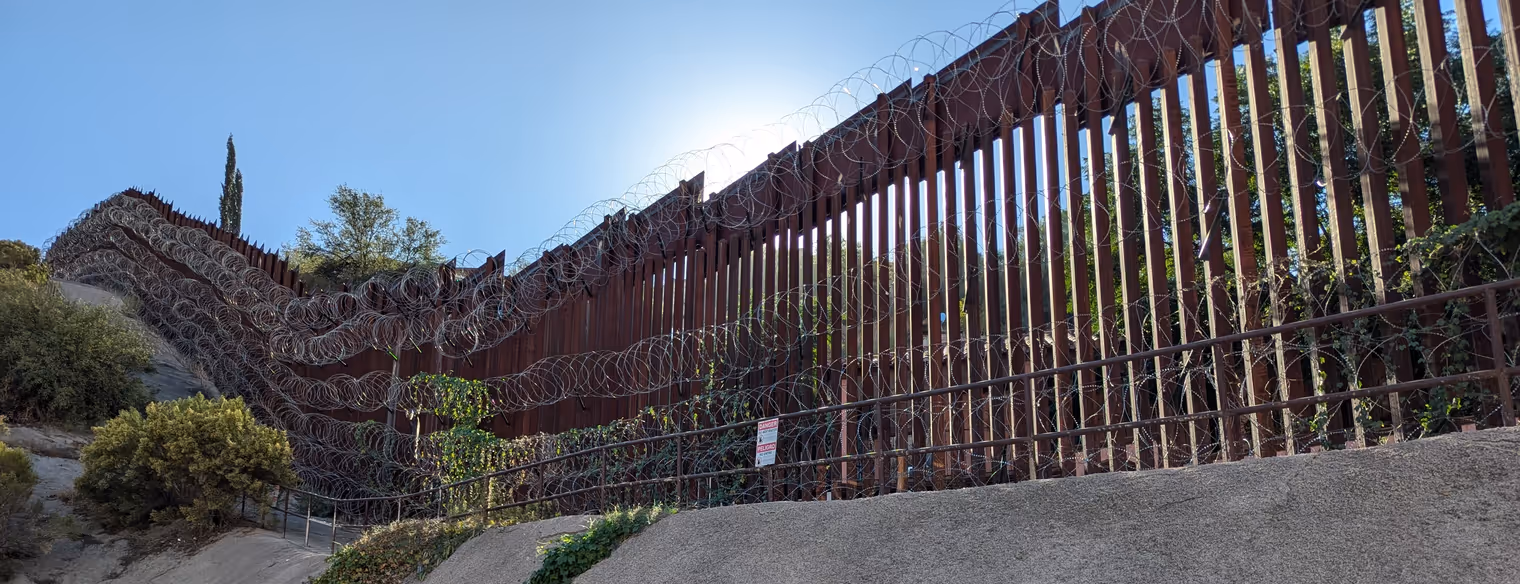
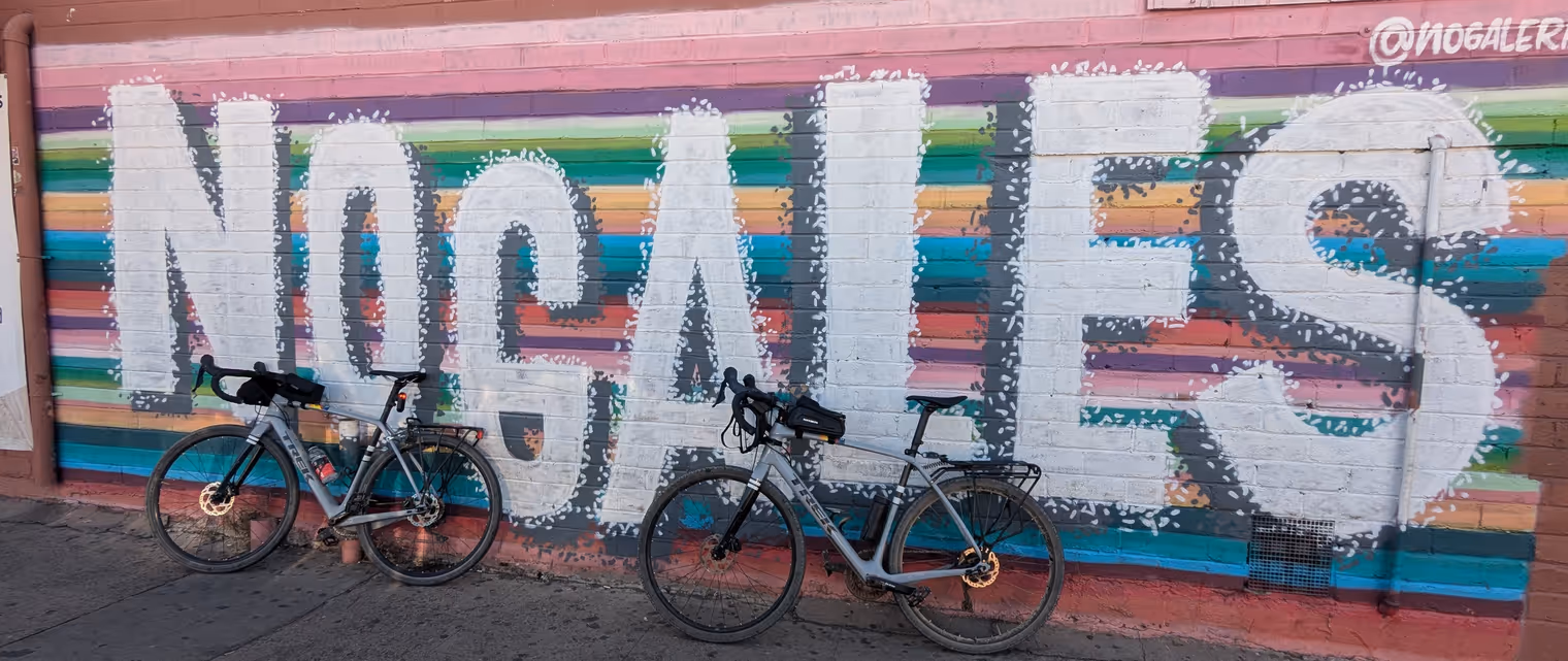
We then take a quick visit to downtown Nogales. We want to see the border and the famous wall, but above all we need to do laundry. We’re visiting the east side of town when we hear the deep whistle of a train and the clanging of a closing grade crossing. It’s a freight train bound for Mexico; five kilometers long. There are no underpasses, so we have to wait.
By mid‑morning we’re ready to head to Patagonia, a small town with a Wild West feel that’s become popular among cyclists as the starting point of a 100‑mile gravel ride. It really is a nice place, with various little shops and a few restaurants. It’s still an American town though, with a four‑lane road running through the center and rows of parked cars along it.
In the late afternoon we check into the Airbnb that will host us for the next three days, a rural little house on the hills behind Patagonia. It’s been a light day, but a much longer ride awaits us tomorrow. Better rest up.
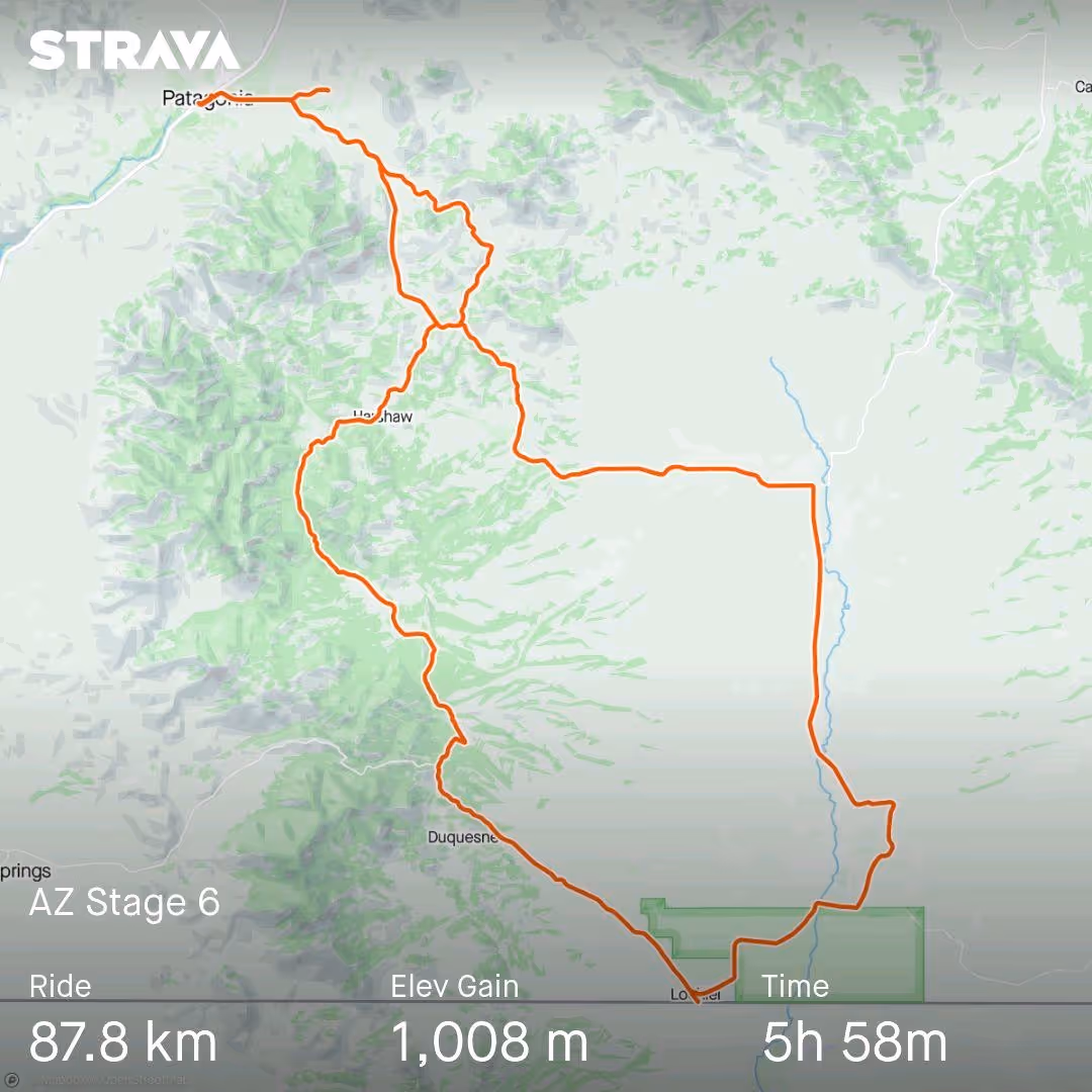
Day 6: Lochiel and the Rafael Valley
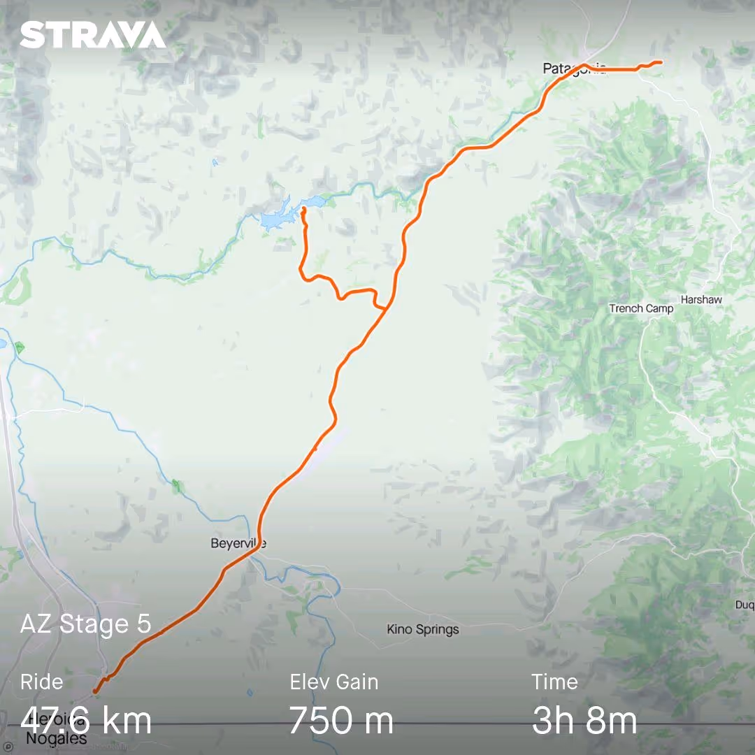
When, in June this year, Davide and I decided on an American bike adventure, we initially thought of a loop in New England, the geographic area in the northeast of the U.S. that includes states like Pennsylvania and Massachusetts. We quickly realized, however, that it’s cold there in October, and we started scanning the map for a milder alternative. In our research, we were struck by (and convinced to pick Arizona by) a YouTube video of a group of cyclists calling Patagonia “the Mecca of gravel cycling,” praising (and showing) one route in particular that leads to the ghost town of Lochiel on the Mexican border. That’s exactly the route on our plan today; let’s hope it doesn’t disappoint.
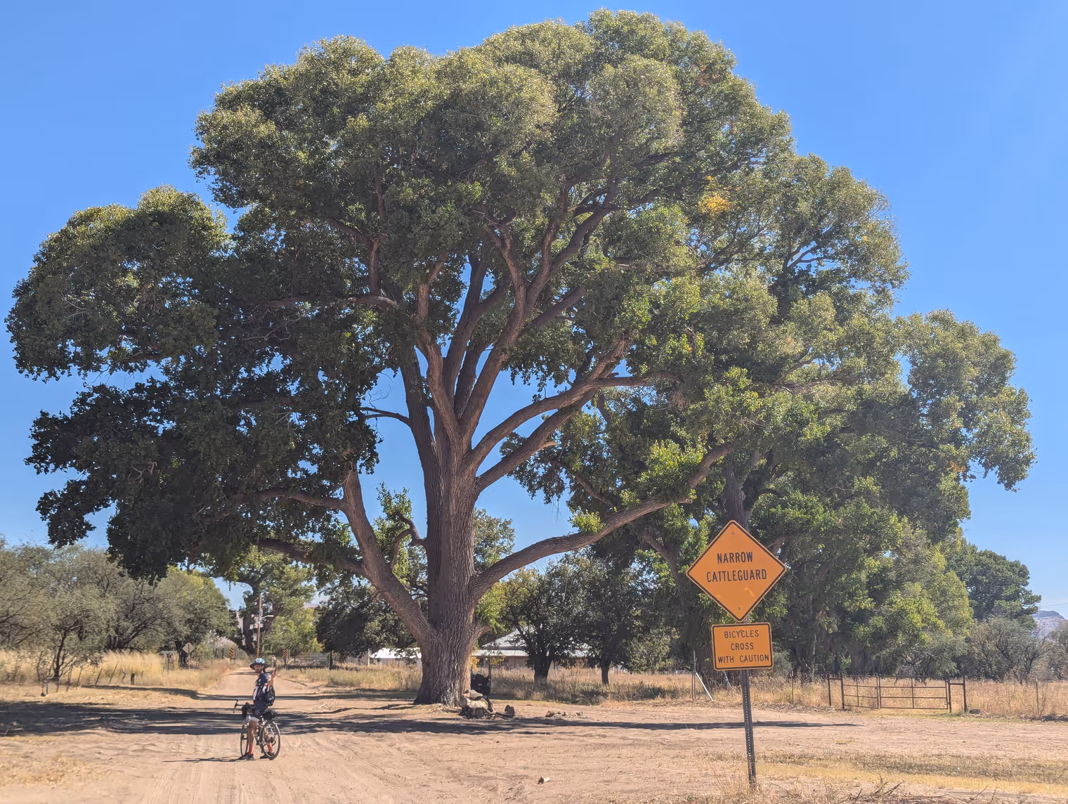
We mount up at 8 sharp, and first stop is downtown Patagonia to stock up on water and provisions for the day. I have a filter with me so that, in an emergency, I can drink from a river or lake. I don’t think it’ll be very useful; so far all the supposed rivers the maps showed us have turned out to be seasonal courses, currently bone‑dry. Today’s ride will take us to truly remote places, so I load 4.6 liters split between water and electrolytes. We’ll have roughly a thousand meters of elevation, so I’d gladly do without all this extra weight, but there’s no alternative.
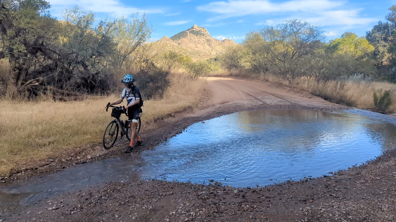
The first third of the route takes us south, climbing the Patagonia Mountains massif through a series of ravines. To our surprise, we find a live stream, with water! The road crosses it in multiple points, and we even have to ford it. I’m almost tempted to try the filter.
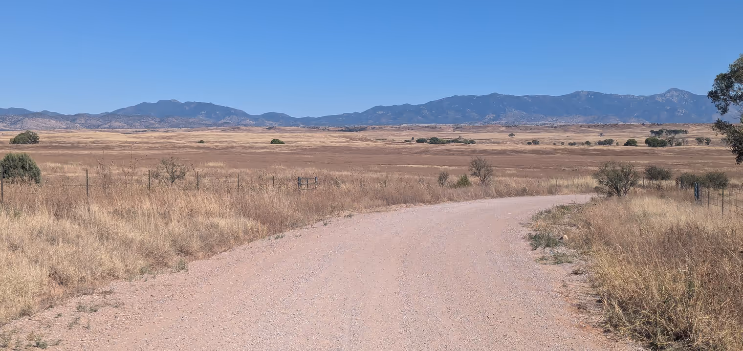
Looking at the topo map, I thought this first third would be the most interesting part of the ride. The road, however, is a corridor through the vegetation and doesn’t offer great views. But after the last crest the scenery changes all at once. The Rafael Valley opens before us, an immense golden prairie dotted with the bright green crowns of huge poplars. In the middle of the valley, a line of deeper green suggests the presence of a river; who knows if there’s water there too! On the horizon, the valley rises up the wall of the Huachuca Mountains.
Thus begins the long descent to the ghost town of Lochiel, where we stop for a packed lunch. Hearing the term “ghost town,” I pictured a Wild West town: saloons, blacksmiths, a bank, the sheriff’s office… all perfectly preserved but abandoned. In reality, in Lochiel we find only some shabby semi‑modern houses, with the usual “no trespassing” signs and piles of junk in the yard. A bit disappointing, but oh well.
The sun is at the zenith when we set off again, but after a few kilometers we have to stop once more: Davide has a flat. Unfortunately the sealant didn’t work in his case, so he has to replace the tube. We’re near the river (alas, dry) in the middle of the valley and can take shelter in the shade while we do the swap. We forget, however, to remove the thorn from the tire that caused the puncture, and an hour after we set off we’re back to square one: the new tube is punctured too. It deflates slowly though, so we manage to finish the loop simply by stopping every half hour to give it a few pumps.
Back in Patagonia we see the first cyclist of the day. Wasn’t this supposed to be a Mecca of cycling? Looks like our YouTube friends hyped the area’s popularity a bit. They weren’t wrong about the beauty, though.
Day 7: rest
We don’t have anything particular planned for today. Maybe a short outing to a small pass nearby; but we start by rolling down to Patagonia for breakfast and we’ll see how the wind blows afterward.
Picking a café isn’t hard: there’s only one, Gathering Grounds. It’s the typical Anglo‑style café that opens early, serves breakfast until about 11, then simple lunches, and closes at three in the afternoon.
One dish in particular catches our eye: biscuits and gravy, a Southern U.S. specialty—two savory, soft, crumbly biscuits drowned in a béchamel‑like cream enriched with little bits of sausage. The whole thing comes with fried eggs and roast potatoes.
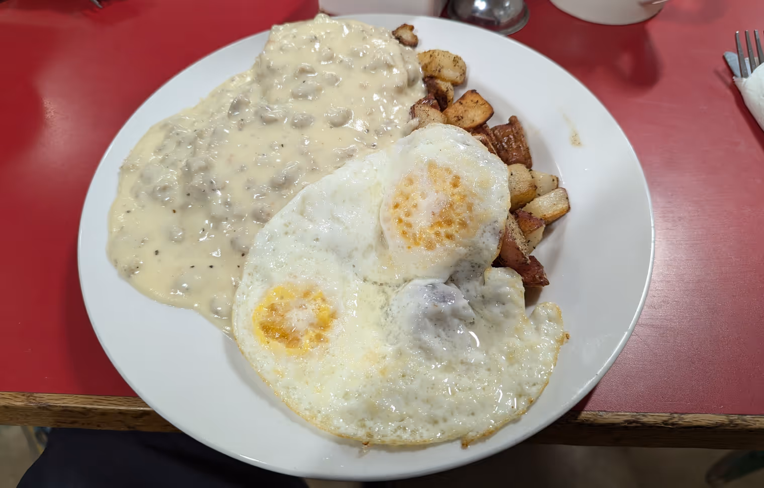
Fantastic combo, exquisite flavor, but it’s a brick. It’s two in the afternoon before I stop feeling full. Whatever sliver of desire we had to go ride evaporates completely. We’ll take the rest day. No big deal—my knee was sending me odd signals yesterday too. No pain, but a bit of rest certainly won’t hurt.
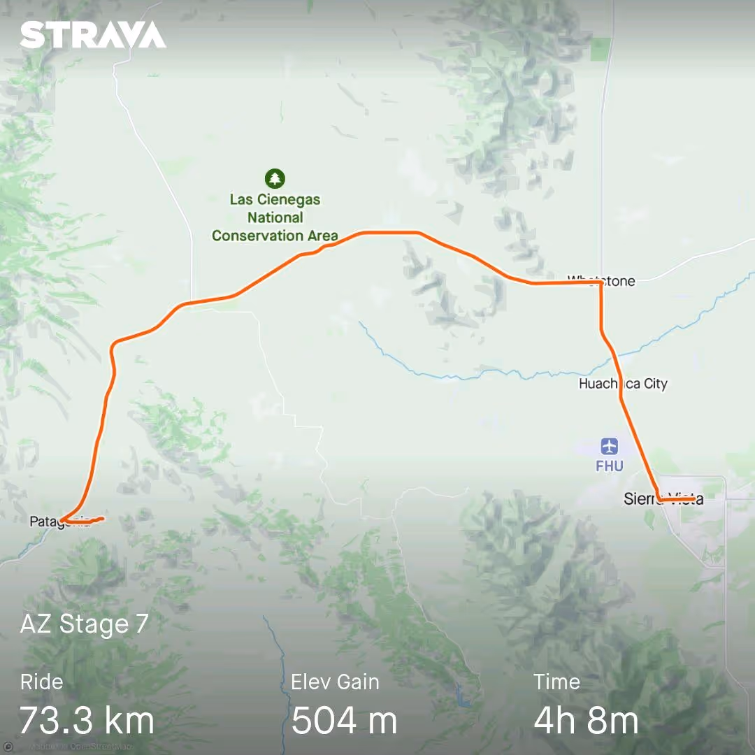
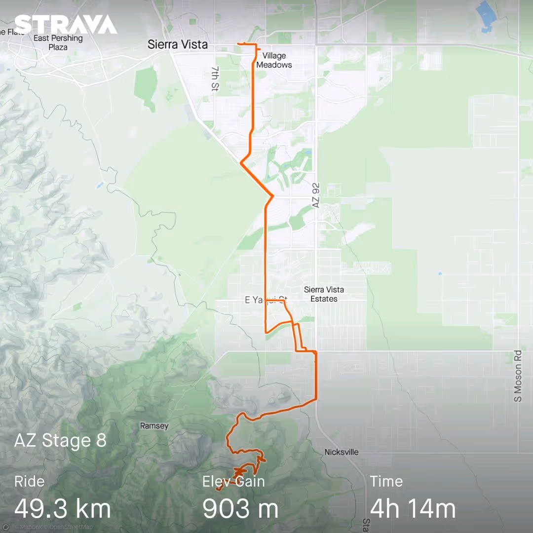
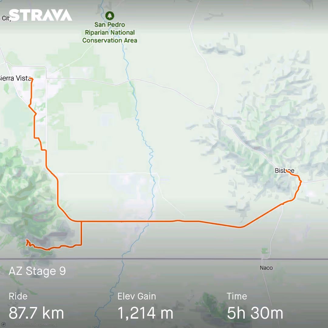
Day 8: toward Sierra Vista
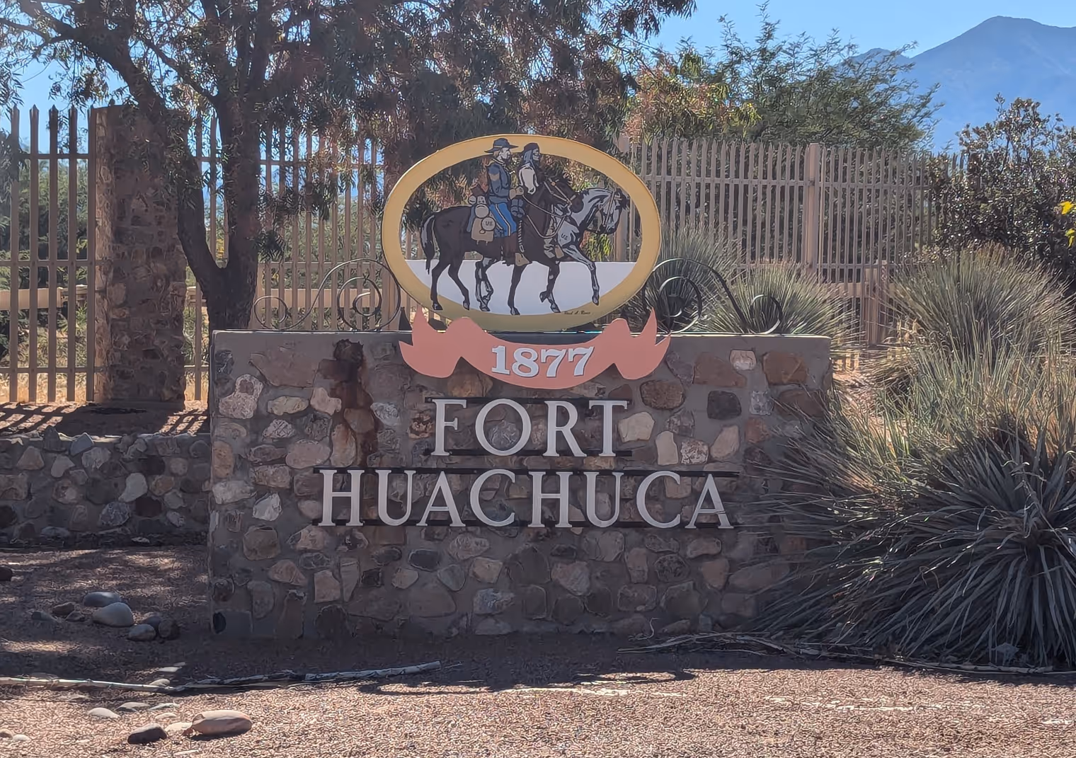
Patagonia and Sierra Vista sit at exactly the same latitude and are connected by a dirt road that runs along the north side of the Rafael Valley, gradually climbs to Fort Huachuca, and crosses it to reach Sierra Vista.
We thought a remote and peaceful route awaited us, but we hadn’t factored in that Fort Huachuca is actually an active military base. I call to ask whether we’re allowed to pass through, but they tell me foreign citizens must be escorted by a service member or veteran who vouches for them. No dice.
The fort is protected to the south by dozens of miles of impenetrable mountains (at least by bike), so we have no choice but to ride around it to the north, climbing up to the little town of Sonoita, following the Cienega Valley east, and ending by heading south again. A few extra kilometers, but at least it’s all pavement and the valley still offers first‑rate views.
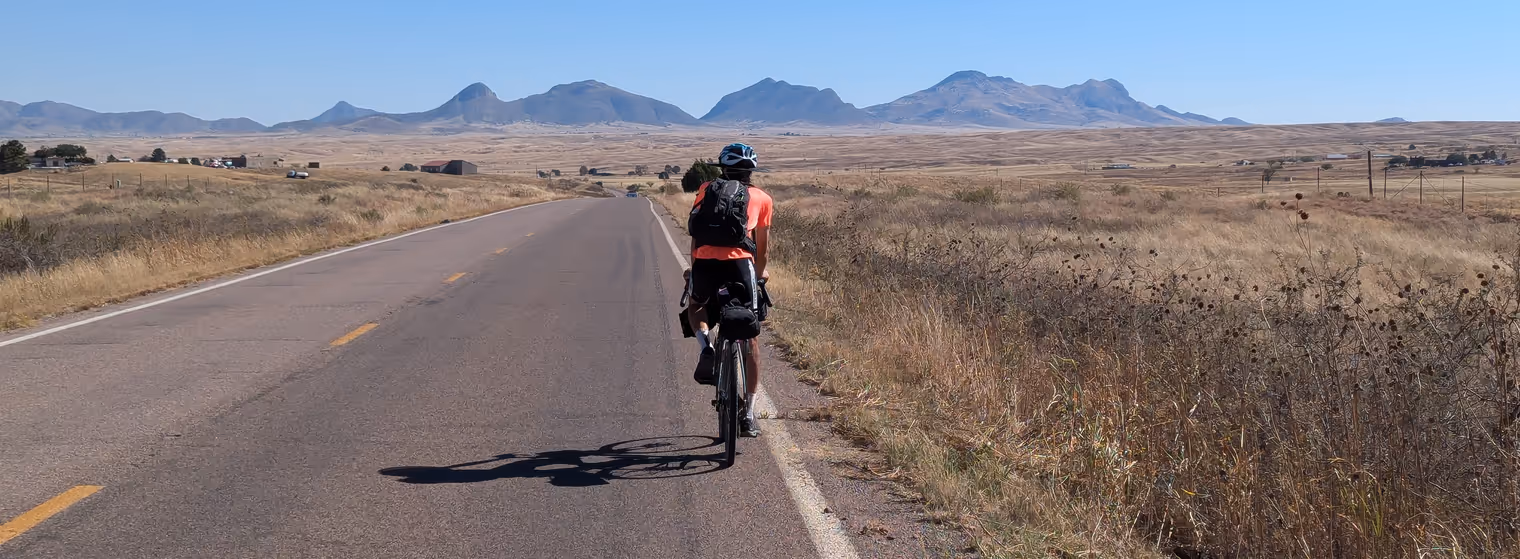
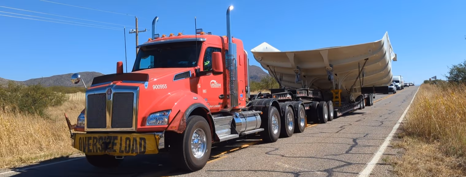
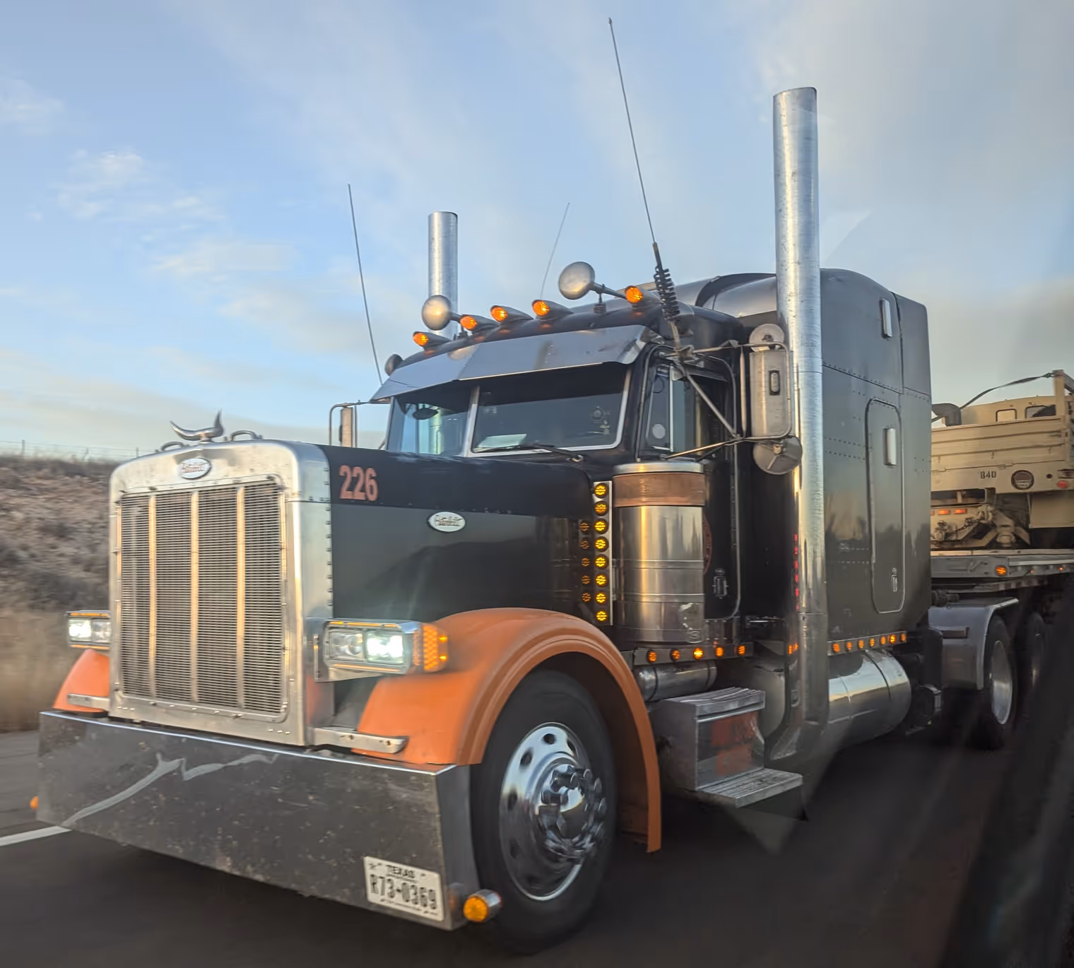
Even though they’re public roads, traffic is light and drivers are respectful, so we have no problems. We only have to move aside when we see in the distance an oversized transport hauling a huge steel element—perhaps a component of a ship’s hull. It takes up the entire road, and we really have to ride into the grass at the edge not to get run over. In doing so, my front tire is pierced by a thorn. I pull it out, and once again the sealant plugs the hole. Miraculous.
No further mishaps getting to Sierra Vista, and in the early afternoon—taking note of the pro‑Trump yard signs—we check into the Knights Inn motel where we’ll spend the next two nights.
Day 9: Carr Peak
These diary chapters are getting a bit stereotyped. Then again, so are our days. Wake up around 7, breakfast, check in with family, set off, grocery stop for supplies, a few hours riding, some photos, lunch, more riding, more photos, arrival, shower, dinner, bed… Goda asks me: isn’t it getting boring? It may sound strange, but I’d say no.
On one hand there’s the company of Davide, with whom we can always strike up interesting conversations… or, well, entertain ourselves with a vast repertoire of nonsense. On the other, the travel style means that nearly every day we’re in—or seeing—a different place: new hotel, new restaurants, shops. The views change in surprising ways too.
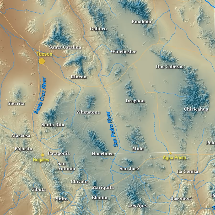
Limited by our strength, our itinerary is naturally circumscribed to a relatively small territory. And yet the diversity of landscape we observe from stage to stage is remarkable. That’s because we’ve landed—fortuitously more than through careful planning—in an archipelago of sky islands; small, isolated mountain groups separated by broad desert expanses. Partly individual differences between one group and the next, partly the geographic barriers they form, and partly changes in altitude, mean that as you cross the sky islands the environment keeps changing.
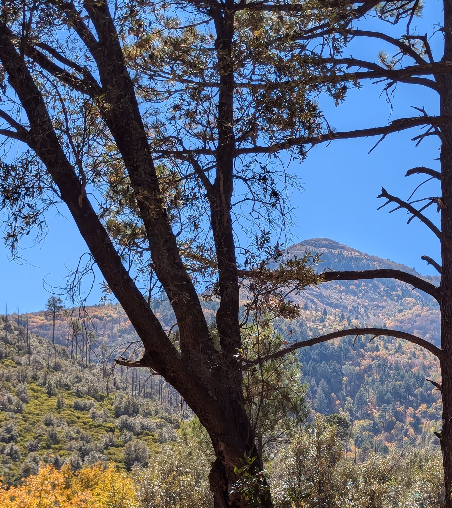
So, on today’s outing, climbing the canyon that takes us to the slopes of Carr Peak, we start in the desert, pass through an oak woodland, finish the ascent surrounded by pines and, looking up, see the summit colored yellow by the autumn aspen.
The only thing that doesn’t change is Davide’s luck—he gets yet another flat. No worries, that’s what spare tubes are for.

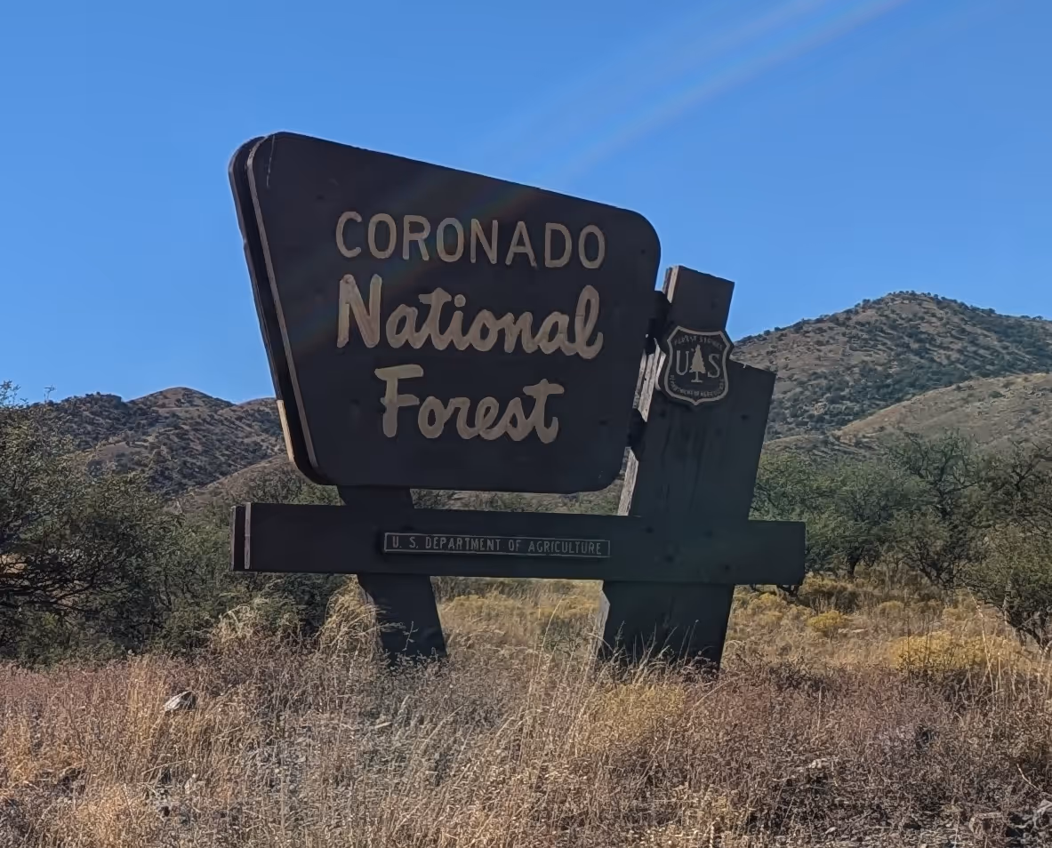
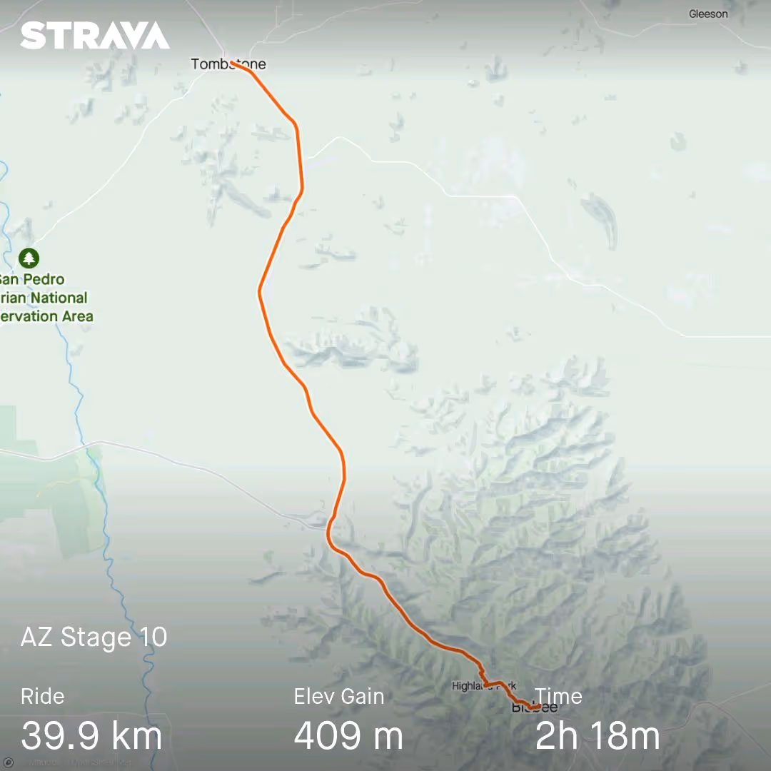
Day 10: Coronado Peak and Bisbee
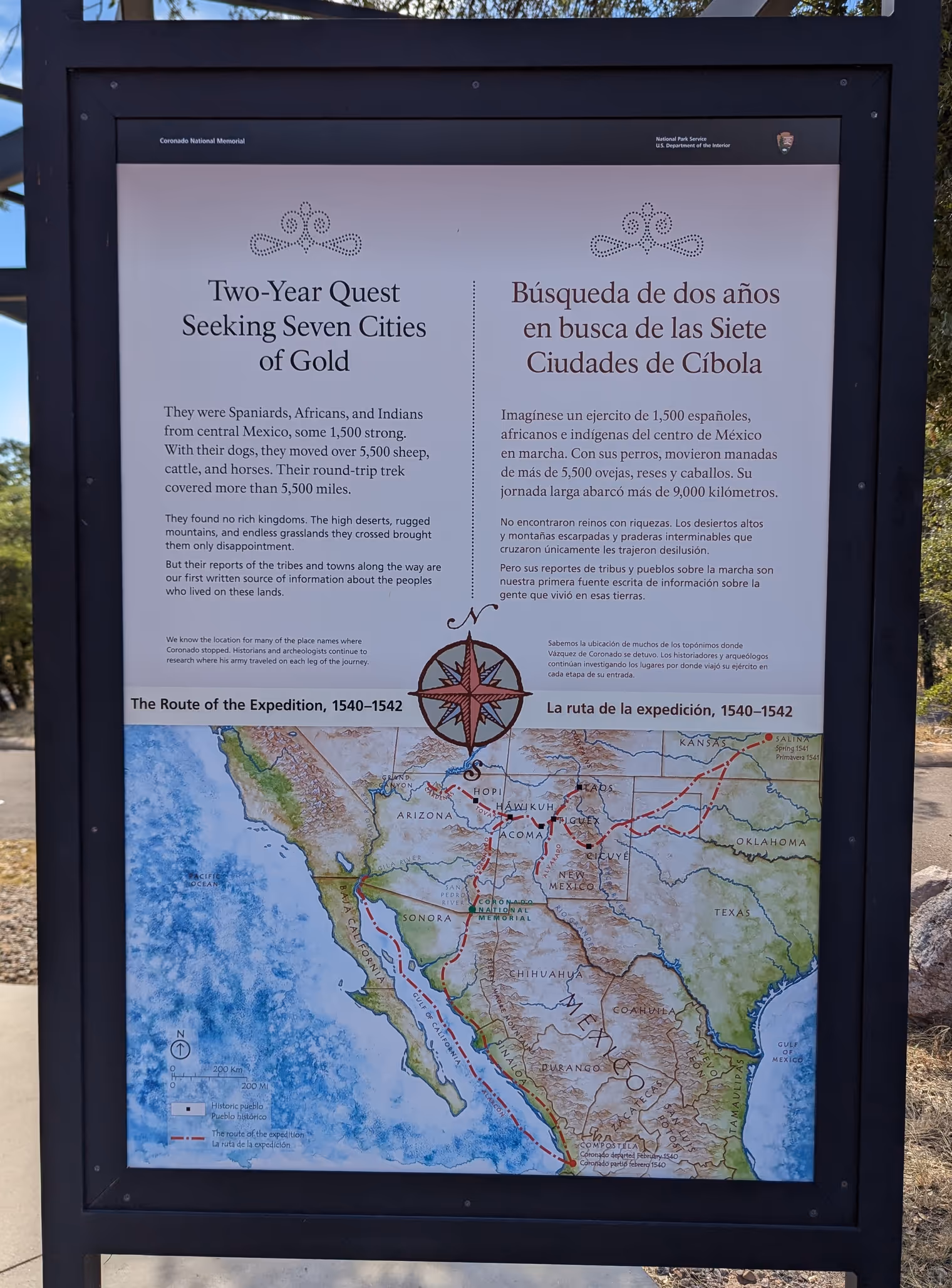
Over the five‑hundred‑plus kilometers of the last ten days, roadside signs have welcomed us multiple times to the Coronado National Forest. Today, here at Montezuma Pass after a long, tiring climb, we finally learned what this Coronado is. Or rather, who he was.
An information panel explains that Francisco Vázquez de Coronado was a Spanish governor and explorer and that, five centuries ago, in 1540, having heard tales of magnificent cities of gold hidden in the northern lands, he set out from Mexico with a party of two thousand men toward what are today the western United States, to find those cities and, naturally, conquer them.
Unfortunately for him, the tales were just legend, but the expedition wasn’t entirely in vain; Coronado’s men were the first Europeans to discover the Colorado River, the Grand Canyon, and indeed these very territories where we are now. In short, they had a great vacation—much like ours.
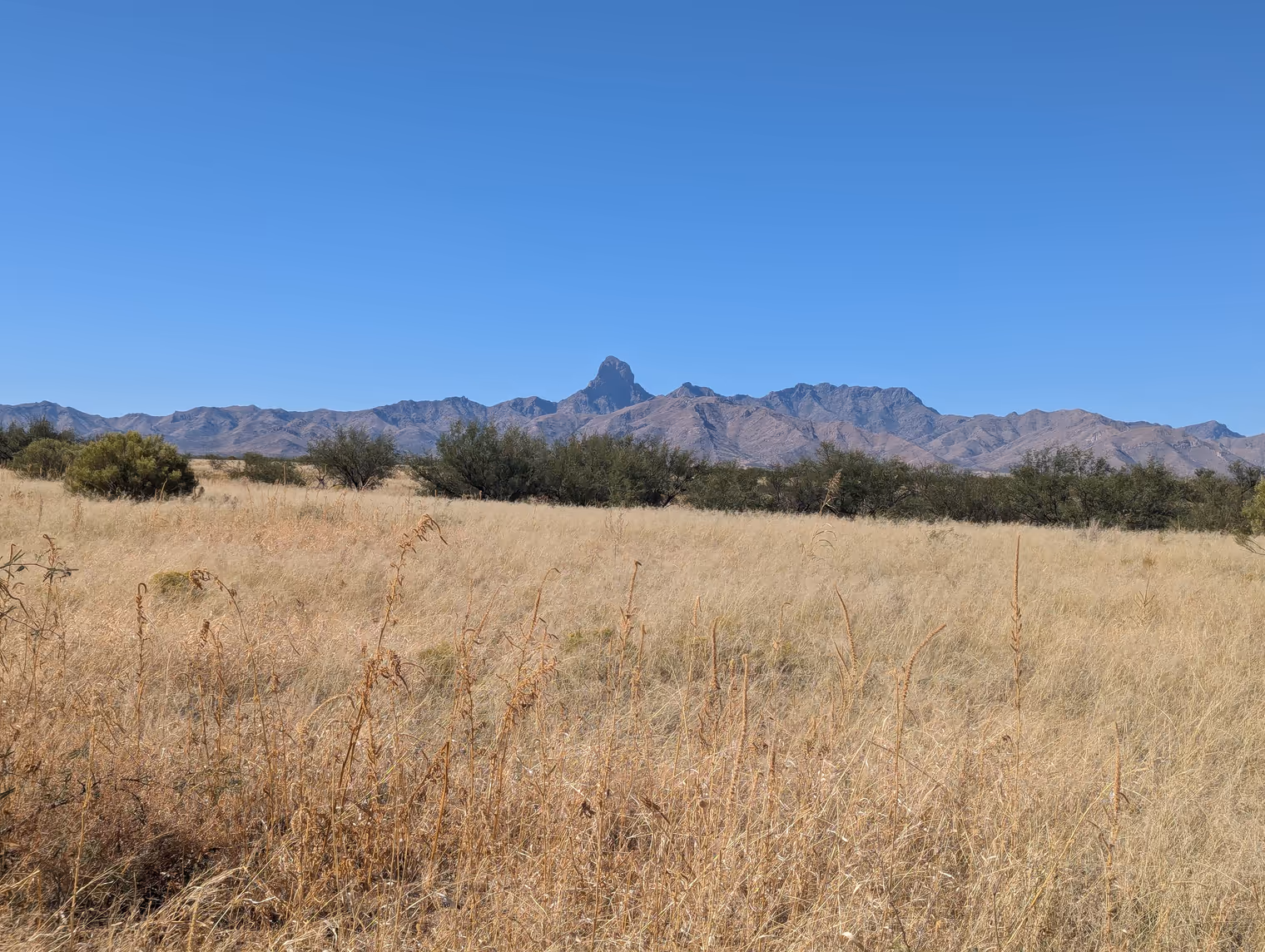
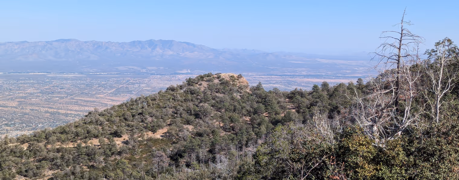
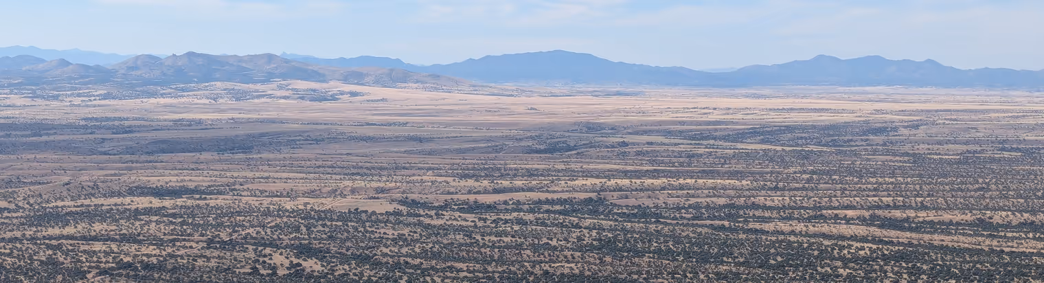
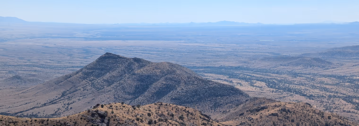
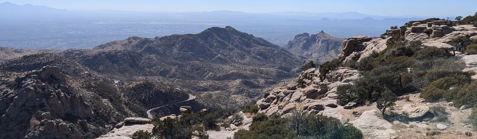
After refueling in the Montezuma Pass parking lot (crackers with peanut butter for me today), we leave the bikes for half an hour to hike up nearby Coronado Peak. The view from the top is truly special. To the west you can see the entire great prairie of the Rafael Valley that we crossed a few days ago, with the Patagonia Mountains in the background. To the south a barren desert opens up, stretching past the Mexican border to distant mountains on the horizon. Finally to the east is the San Pedro Valley, sliced by a dead‑straight 25‑kilometer road that we’ll ride later to reach the town of Bisbee, tonight’s destination.
I lose myself contemplating the panorama, until Davide’s voice brings me back: “we need to get moving.”
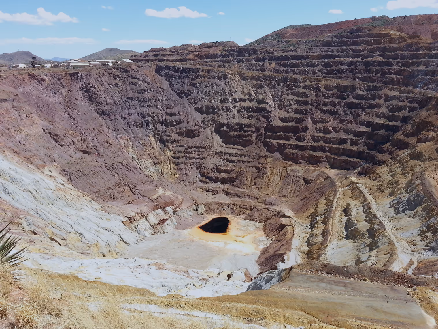
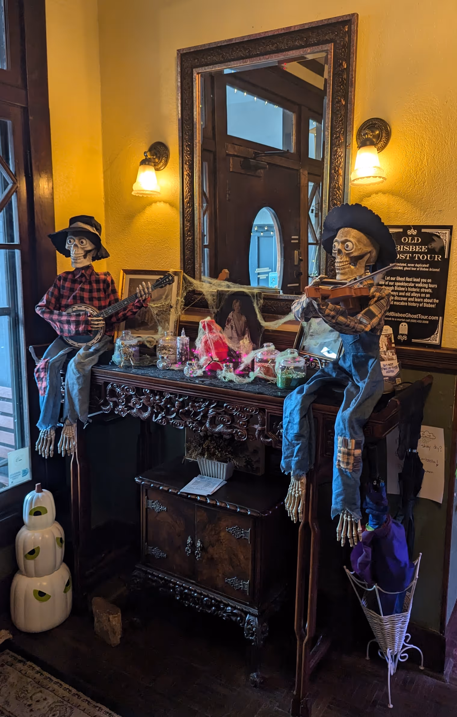
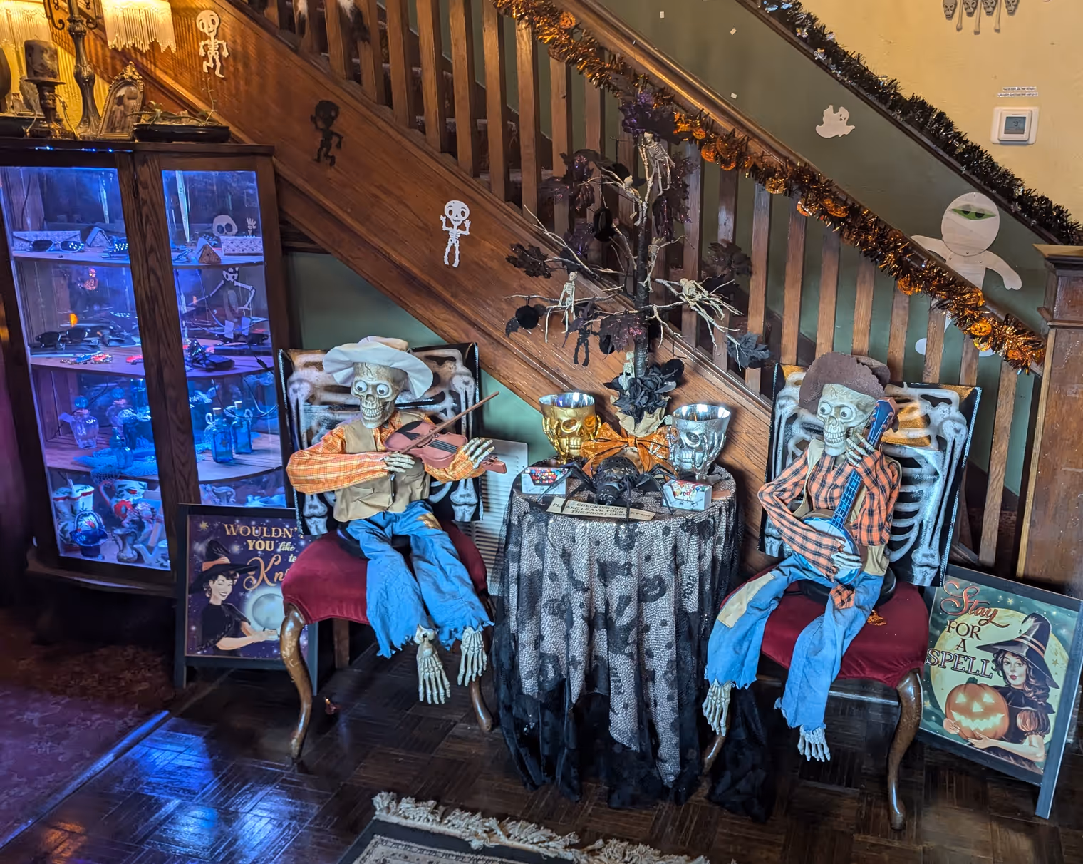
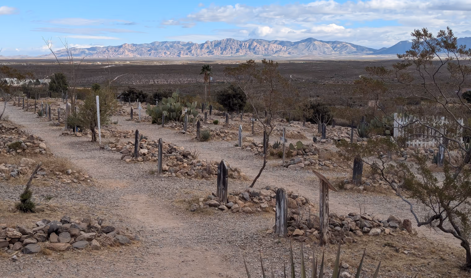
We’ve heard a lot about Bisbee: “it’s a strange place,” “there are eccentric people,” “there are ghosts.” A former mining town (you pass a colossal disused open pit on the way in) nestled in the Mule Mountains sky island, after the mines closed Bisbee reinvented itself as a tourist destination, using the macabre as a theme to attract visitors. We’ve landed here at the perfect time: it’s just days before Halloween.
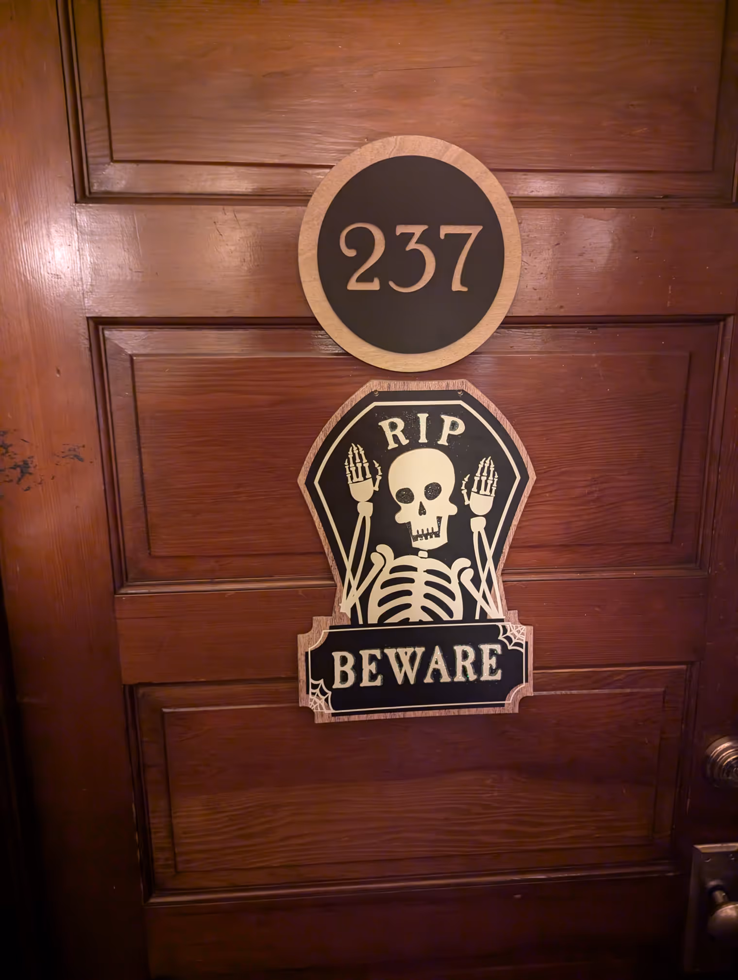
The hotel where we’re staying is decorated to a tee: pumpkins, skeletons, cobwebs, and in the room a portrait of the twins from The Shining. Here’s hoping we can sleep.
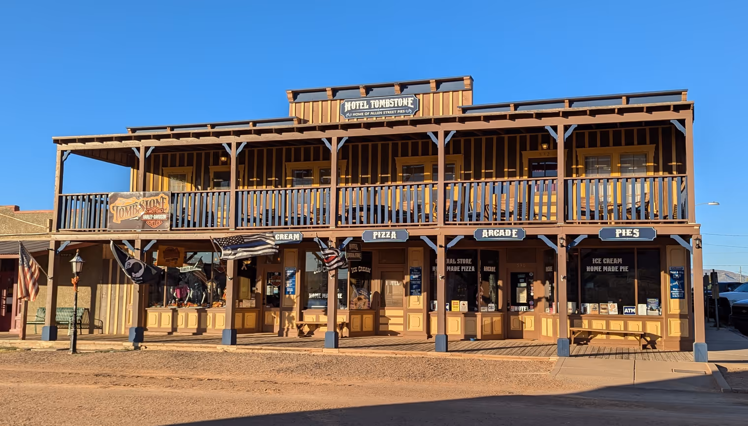
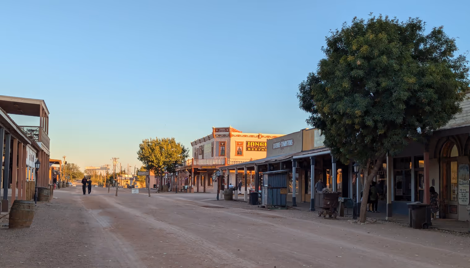
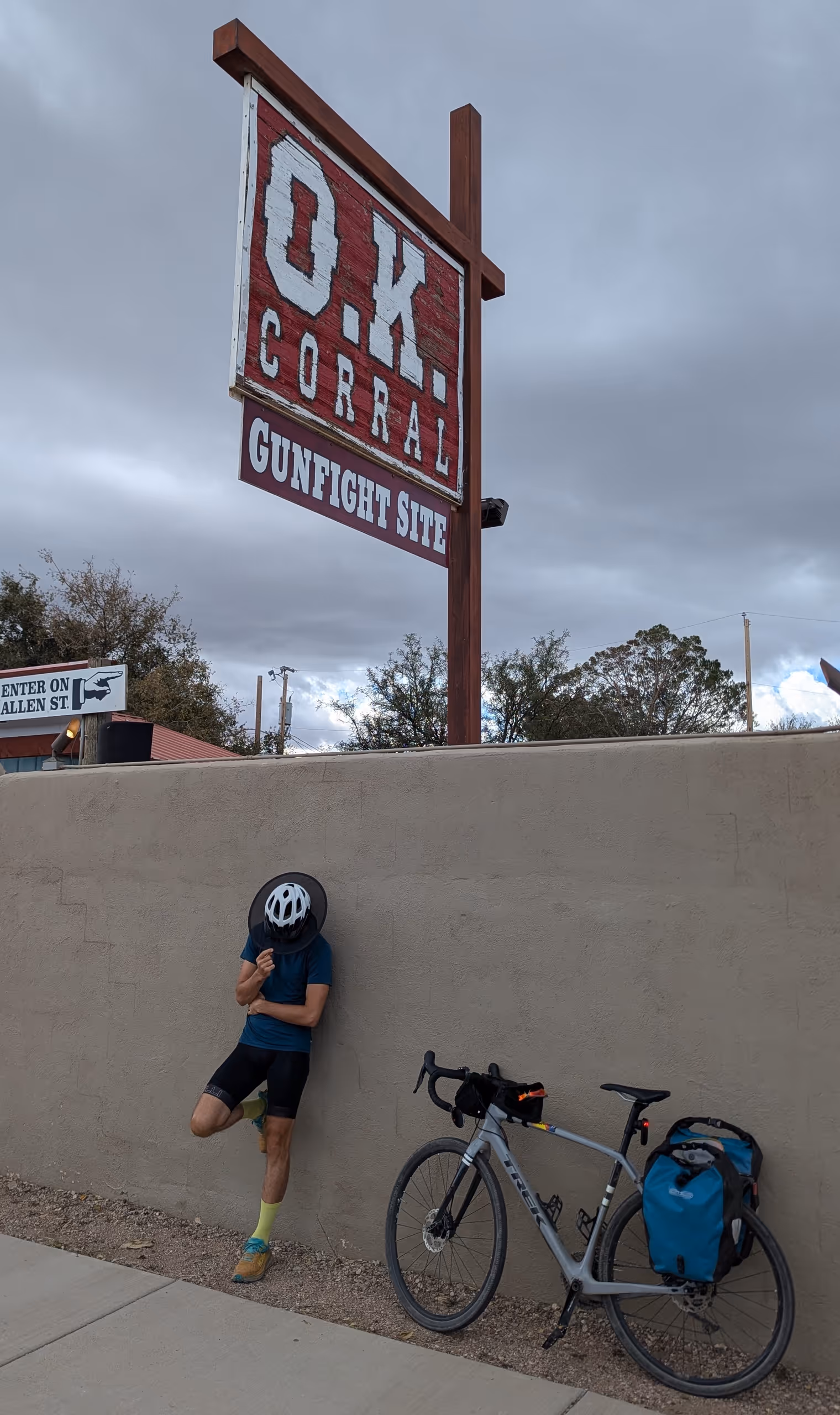
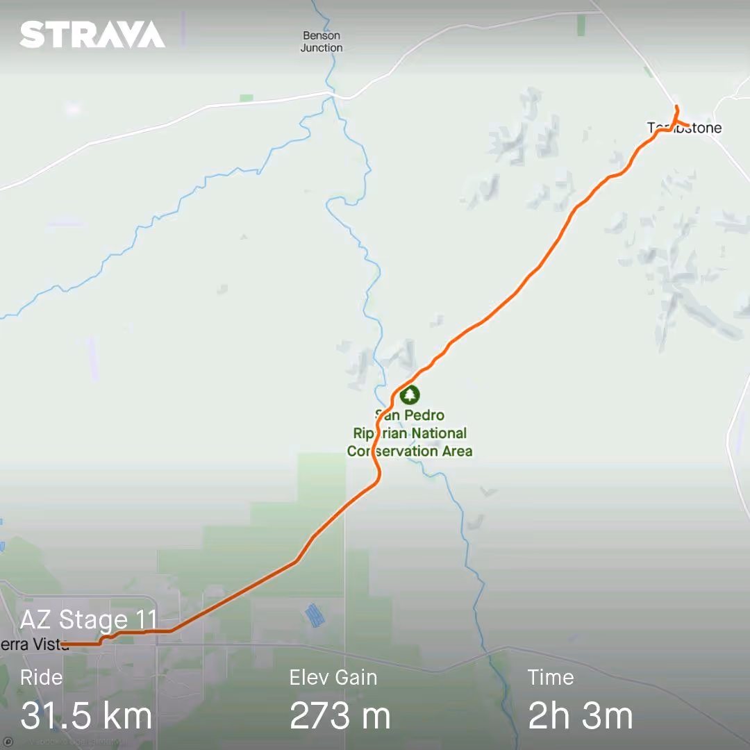
Day 11: Tombstone
The ghosts of Bisbee are very cordial and didn’t disturb our sleep. We go down to breakfast rested, at a café downtown that serves me an orange muffin as big as my open palm. We then set off without hurry; today is a short stage, mostly downhill, with arrival in Tombstone.
In its grand mission to achieve the maximum possible degree of inconsistency in pronunciation, the English language has established that “tomb” is pronounced “toom” (and not “tomb” like “bomb”); thus Tombstone is “TOOM‑stone.” I point this out because for two weeks Davide and I, like real idiots, at every possible occasion have been emphatically mispronouncing “TÒMB‑STÓN,” imitating an unsuspecting Italian travel vlogger who used the wrong pronunciation in a video about the town. Will we stop now that we’re here? Not a chance.
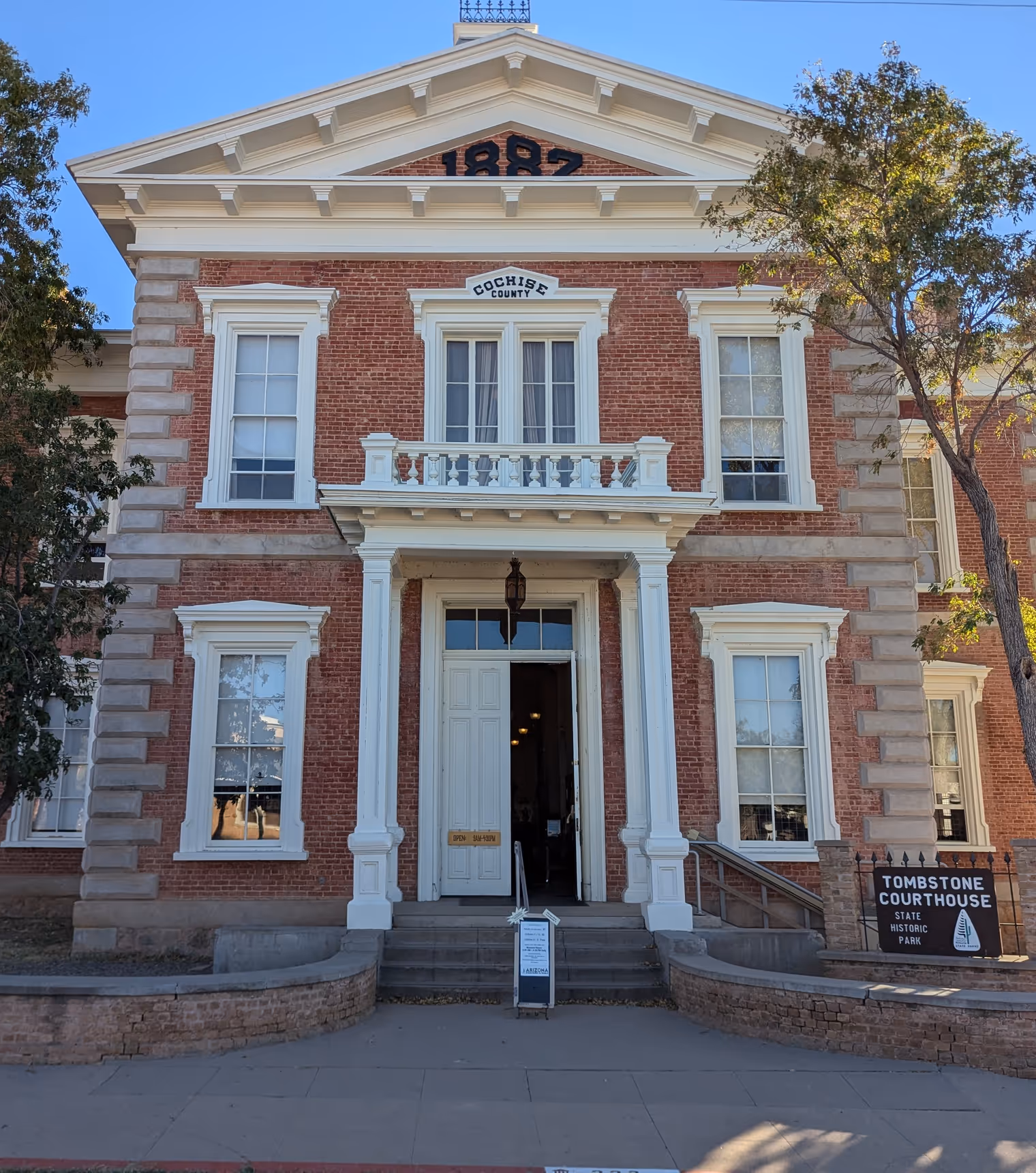
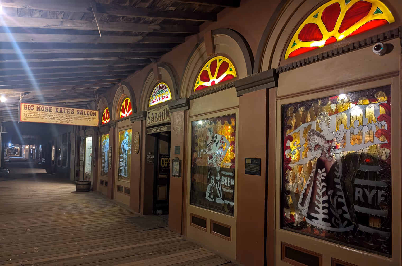
In any case, the travel vlogger (@STEPSOVER, if anyone’s interested) was in TÒMB‑STÓN because the town is famous for having preserved many historic buildings from the Old West: various saloons, a theater, city hall, the courthouse… There’s also the O.K. Corral, which was the scene of an epic shootout between a group of bandits (the Cowboys) and lawmen led by bounty hunter Wyatt Earp.
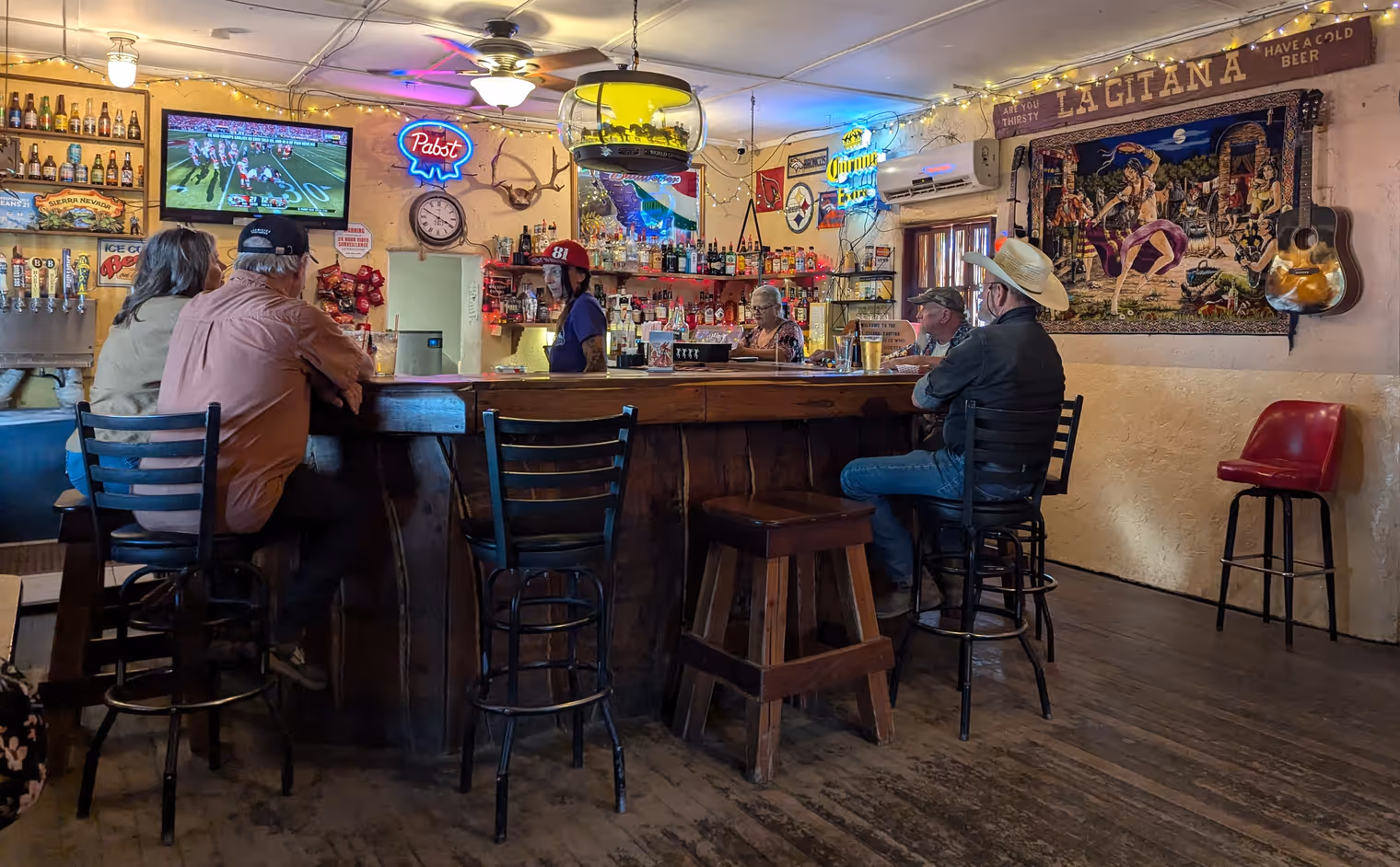
We spend the afternoon visiting the (all in all small) historic center and end the day with dinner at the counter of a saloon. We’re real cowboys.
Day 12: back to Tucson
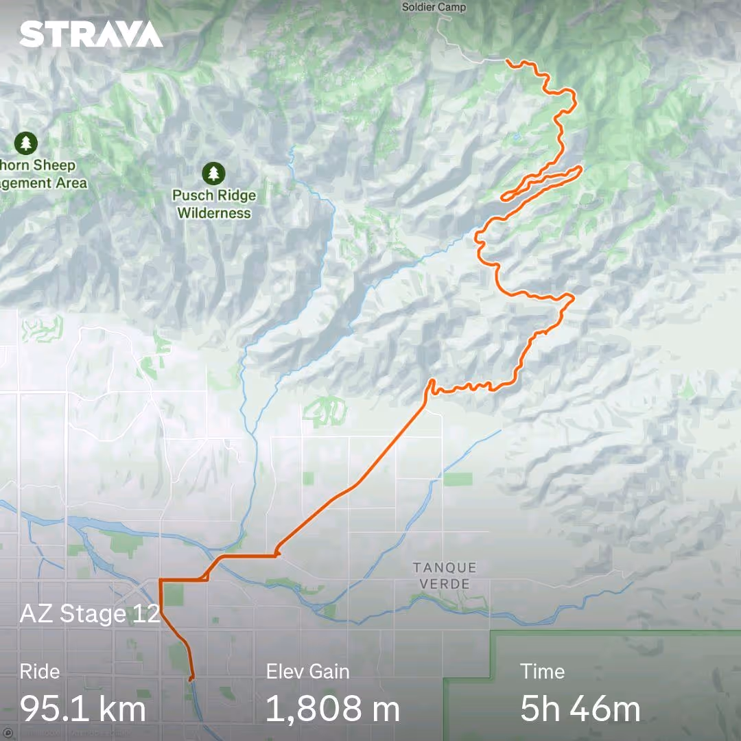
It’s the last days of the trip, and we have to head back to Tucson, where the day after tomorrow we’ll return the bikes. From Tombstone, though, it isn’t easy to reach the city—at least not by bike. The only plausible route is over 120 kilometers, 30 of which on Arizona’s busiest freeway, which Republican representative Mr. Ciscomani is currently using as a campaign lever, promising to build a third lane if re‑elected. We’ll try it again when the works are done, but for now we’ll pass.
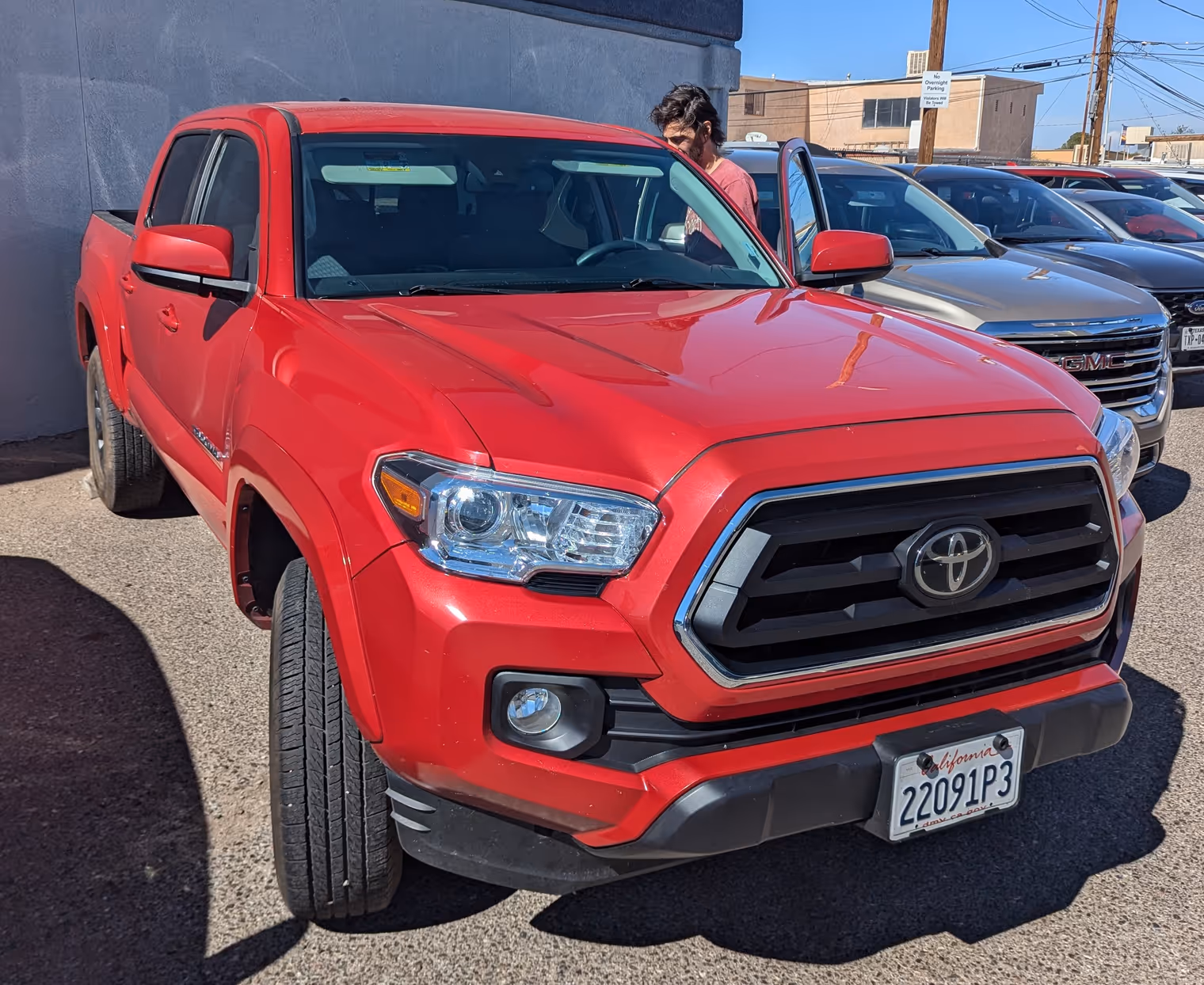
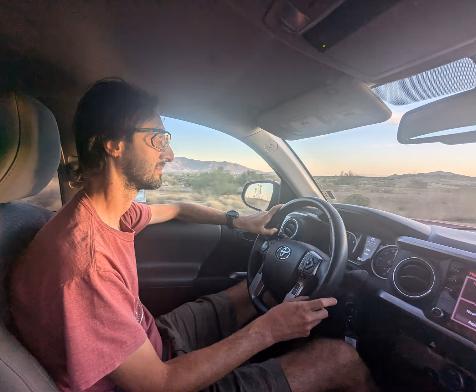
So we opt for the motorized alternative. We ride to Sierra Vista, where Davide, armed with an international driver’s license, rents a small pickup truck onto which we load the bikes as best we can. (“Small” is calibrated to American standards.)
We have no schedule constraints for arriving in Tucson, so we take advantage of the vehicle to go visit Apache Pass in the Chiricahua Mountains, a large sky island on the border with New Mexico.
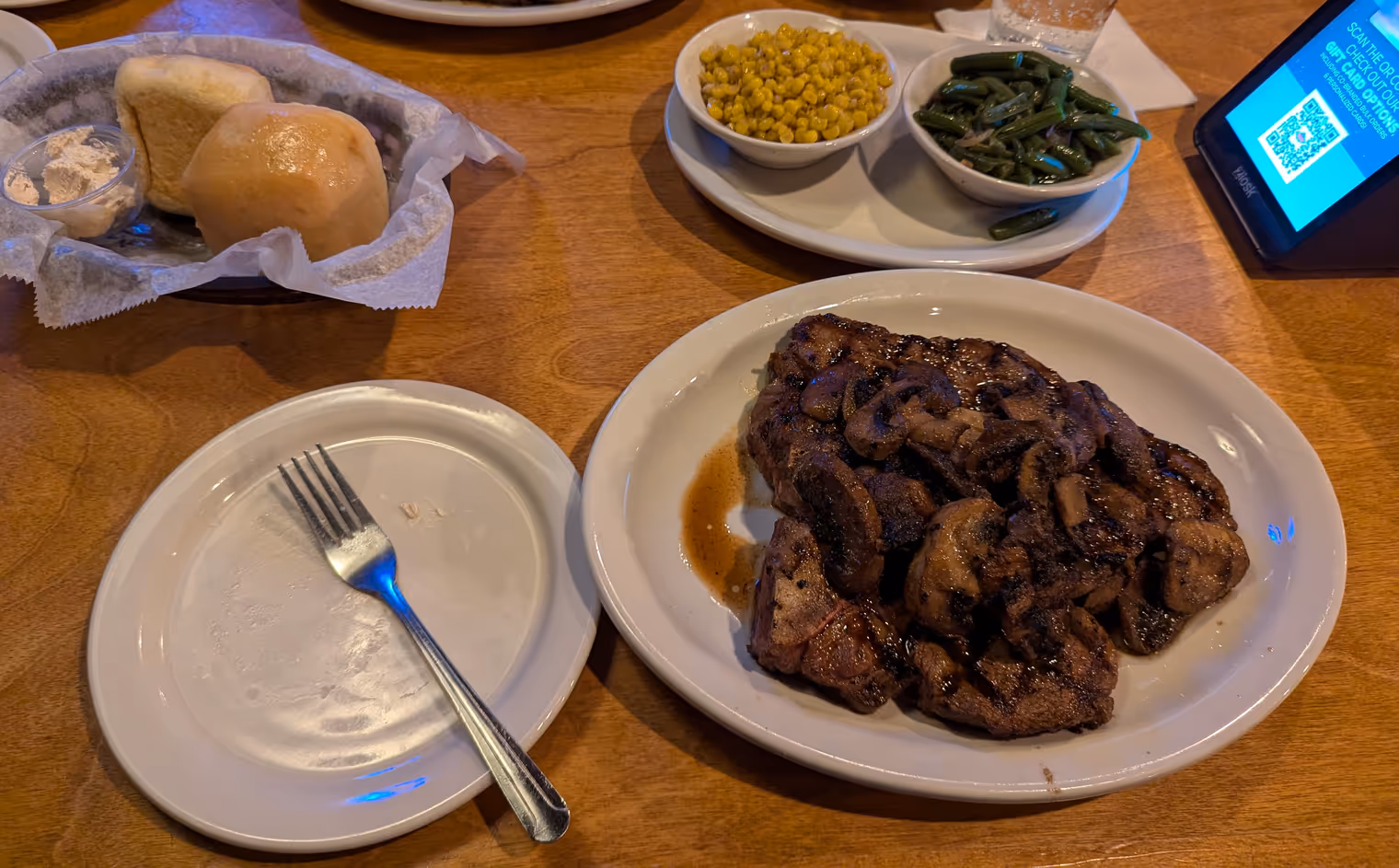
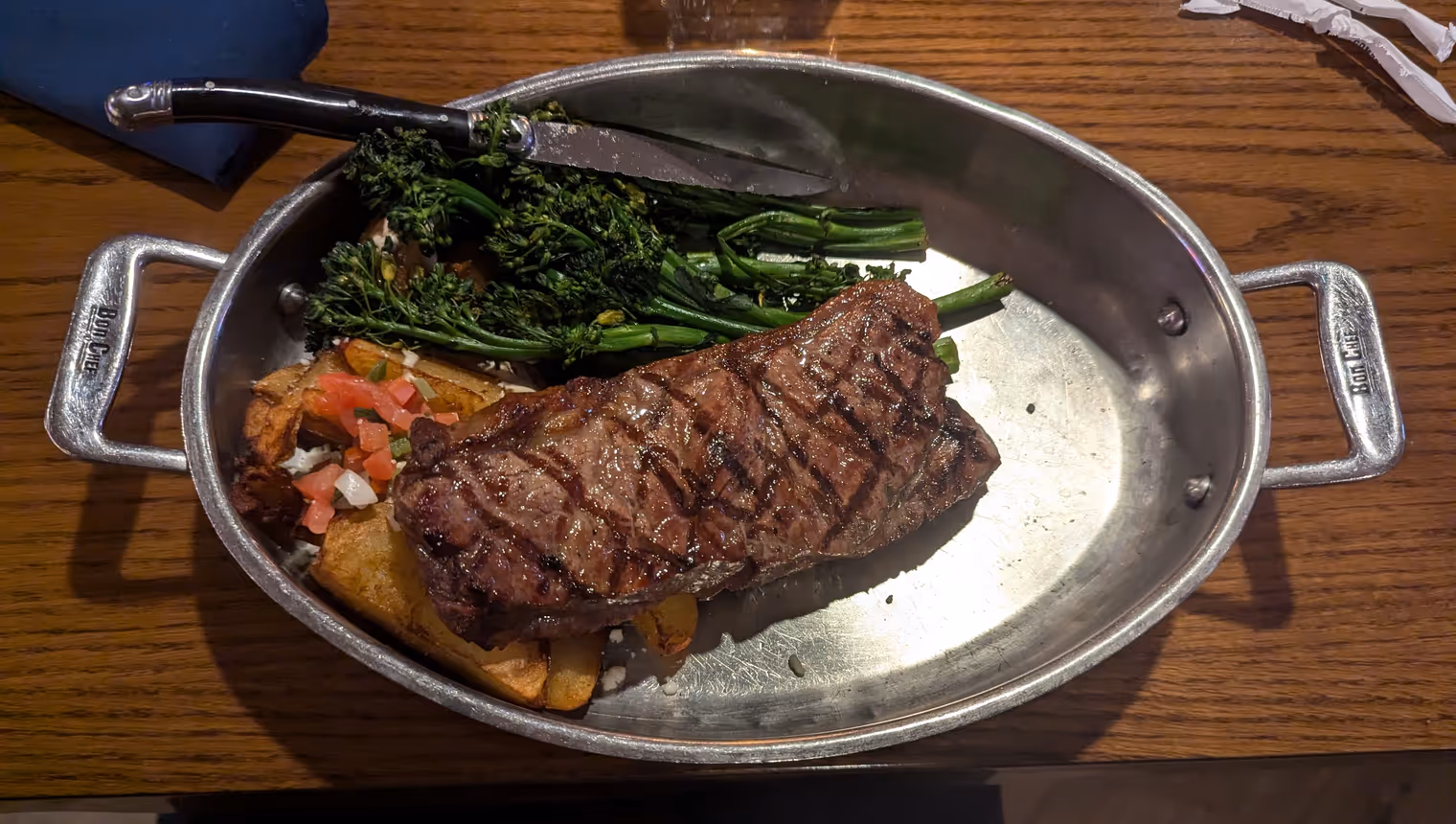
After so many hours in the pickup, our inner true American awakens, and as we get into Tucson at sunset we duck into a Texas Roadhouse for a 700‑gram T‑bone steak that accompanies us all night in a… heavy sleep.
Day 13: Mount Lemmon
Last real day in the saddle. To finish in style, we’ll tackle what many cycling publications count among the most beautiful climbs in the United States: Mount Lemmon, the highest peak in the Santa Catalina Mountains. From the traditional start point of the climb, it’s 45 kilometers to the summit with more than 2,100 meters of elevation gain. We, however, are starting from our hotel, so in total we’re looking at 120 kilometers today and 2,500 meters of climbing; honestly I don’t think we’ll make it all the way.
It’s a sunny day, even if the temperature has dropped a bit compared to previous days. The high is forecast at 25 degrees, versus the 35 we’d gotten used to.
We begin the climb on a slope thick with saguaros. It’s a steady 5% (50 meters of elevation per kilometer), and we quickly rise above the Tucson plain. It’s already been an hour and a half since we left the hotel and, seeing a scenic turnout by the roadside, we take the opportunity for a snack. When he’s out riding, Davide has the pro habit of frequent calorie top‑ups (about every hour and a half) so he can take in all the energy needed for the ride without ever getting too weighed down. It’s genuinely a good approach; my strategy of stuffing myself at lunch and then dragging myself around like a zombie while digesting leaves much to be desired.
The zombie scene indeed arrives a couple of hours later when we get going again after lunch. In the space of 15 minutes I ate jerky, two eggs, a salted bagel, a handful of almonds, and half a chocolate bar. Washed down with a liter and a half of Gatorade. (I adopt the same strategy for drinking.) I feel a brick in my stomach and a terrifying drowsiness. Why do I never learn…
It takes another hour and a half of climbing through the scenic Santa Catalina valleys to reach the Palisades campground area, 15 kilometers from the top of Mount Lemmon. We decide to stop here. We’d love to complete the climb, but that would mean risking the ride back in the dark.
We’re at 2,420 meters, and it’s quite cold. I bundle up in every garment I have with me, and we begin the long, pleasant descent back to Tucson. What better way to crown the end of our Arizona cycling adventure.
Days 14 and 15: heading home and reflections
We actually ride today too, but only to bring the bikes back to the rental. Then a taxi to downtown Tucson, bus to Phoenix, and here we are again, in the same hotel where we met two weeks ago, in front of a big steak with which we celebrate the last dinner of the trip.
What can I say—it really was a great trip. We crossed incredible nature, discovered legendary places, and above all had a ton of fun. On the other hand, though, this experience makes me notice how my perception of the United States has changed over the years.
I remember my first visit to Indiana at seventeen, exactly half a lifetime ago. I found myself in the America I had seen only in movies until then: houses with yards in residential neighborhoods, barbecues with the neighbors, enormous supermarkets open 24 hours… I felt I was in a new place that at the same time was extremely familiar to me. I was then deeply struck by the rural character—the stretches of farmland, the barns, the fairs, the Amish on horseback. I remember writing home saying I wanted to buy fifty acres of land and build a farm. Then, eight years later in Colorado, I was charmed by the sporty, carefree atmosphere that permeates the towns at the foot of the Rockies. In both cases I found an America I would have liked to live in.
This time, though, no. Maybe it’s the effect of the hundreds of “no trespassing” signs I saw these two weeks, the road signs perforated by bullets, the trash that often litters the roadside; they give me a sense of hostility, of a culture that’s too individualistic and doesn’t value the collective aspect of society. Or perhaps more simply it’s because, while I find it a fascinating environment, I don’t feel an affinity with the desert.
On our second evening in Three Points, Mr. Kevin was struck by Davide’s answer to his question about why he had moved to Japan: “because in Japan I feel like myself.” And I have a clear sense that here in Arizona, and probably in the rest of the United States, today I wouldn’t feel like myself.
From the window of the little Embraer E190 taking me from Warsaw back to Vilnius, my gaze falls on Lithuania’s patchwork of fields and forests. I think of runs in the woods, mushroom picking, canoe trips, autumn days and apple pies. Yes—here I feel like myself.